You are here: Home > Network List > IU - Global Seismograph Network (GSN - IRIS/USGS) Stations List
> Station PMG Port Moresby, New Guinea > Earthquake Result Viewer
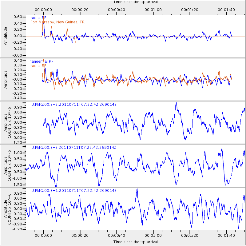
PMG Port Moresby, New Guinea - Earthquake Result Viewer
*The percent match for this event was below the threshold and hence no stack was calculated.
| Earthquake location: |
Kermadec Islands Region |
| Earthquake latitude/longitude: |
-29.5/-176.6 |
| Earthquake time(UTC): |
2011/07/11 (192) 07:15:43 GMT |
| Earthquake Depth: |
11 km |
| Earthquake Magnitude: |
5.5 MB, 6.0 MS, 6.1 MW, 5.9 MW |
| Earthquake Catalog/Contributor: |
WHDF/NEIC |
|
| Network: |
IU Global Seismograph Network (GSN - IRIS/USGS) |
| Station: |
PMG Port Moresby, New Guinea |
| Lat/Lon: |
9.40 S/147.16 E |
| Elevation: |
90 m |
|
| Distance: |
39.4 deg |
| Az: |
293.03 deg |
| Baz: |
125.593 deg |
| Ray Param: |
$rayparam |
*The percent match for this event was below the threshold and hence was not used in the summary stack. |
|
| Radial Match: |
59.4429 % |
| Radial Bump: |
400 |
| Transverse Match: |
65.76335 % |
| Transverse Bump: |
400 |
| SOD ConfigId: |
558545 |
| Insert Time: |
2013-09-18 22:01:13.720 +0000 |
| GWidth: |
2.5 |
| Max Bumps: |
400 |
| Tol: |
0.001 |
|
Signal To Noise
| Channel | StoN | STA | LTA |
| IU:PMG:00:BHZ:20110711T07:22:42.269014Z | 2.5659227 | 6.588409E-7 | 2.567657E-7 |
| IU:PMG:00:BH1:20110711T07:22:42.269014Z | 1.6305912 | 4.3720846E-7 | 2.6812882E-7 |
| IU:PMG:00:BH2:20110711T07:22:42.269014Z | 1.1887951 | 3.4287288E-7 | 2.884205E-7 |
| Arrivals |
| Ps | |
| PpPs | |
| PsPs/PpSs | |


