You are here: Home > Network List > IU - Global Seismograph Network (GSN - IRIS/USGS) Stations List
> Station RSSD Black Hills, South Dakota, USA > Earthquake Result Viewer
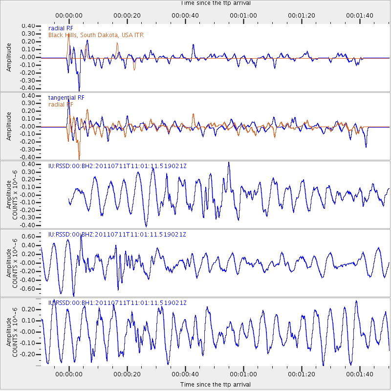
RSSD Black Hills, South Dakota, USA - Earthquake Result Viewer
*The percent match for this event was below the threshold and hence no stack was calculated.
| Earthquake location: |
Tonga Islands Region |
| Earthquake latitude/longitude: |
-22.7/-174.7 |
| Earthquake time(UTC): |
2011/07/11 (192) 10:48:32 GMT |
| Earthquake Depth: |
21 km |
| Earthquake Magnitude: |
5.6 MB, 5.4 MS, 5.6 MW, 5.6 MW |
| Earthquake Catalog/Contributor: |
WHDF/NEIC |
|
| Network: |
IU Global Seismograph Network (GSN - IRIS/USGS) |
| Station: |
RSSD Black Hills, South Dakota, USA |
| Lat/Lon: |
44.12 N/104.04 W |
| Elevation: |
2090 m |
|
| Distance: |
92.7 deg |
| Az: |
42.882 deg |
| Baz: |
240.771 deg |
| Ray Param: |
$rayparam |
*The percent match for this event was below the threshold and hence was not used in the summary stack. |
|
| Radial Match: |
75.58251 % |
| Radial Bump: |
400 |
| Transverse Match: |
62.554234 % |
| Transverse Bump: |
400 |
| SOD ConfigId: |
558545 |
| Insert Time: |
2013-09-18 22:04:53.133 +0000 |
| GWidth: |
2.5 |
| Max Bumps: |
400 |
| Tol: |
0.001 |
|
Signal To Noise
| Channel | StoN | STA | LTA |
| IU:RSSD:00:BHZ:20110711T11:01:11.519021Z | 1.8483733 | 4.10974E-7 | 2.223436E-7 |
| IU:RSSD:00:BH1:20110711T11:01:11.519021Z | 1.306321 | 1.5007177E-7 | 1.1488124E-7 |
| IU:RSSD:00:BH2:20110711T11:01:11.519021Z | 1.1616251 | 1.6941816E-7 | 1.458458E-7 |
| Arrivals |
| Ps | |
| PpPs | |
| PsPs/PpSs | |


