You are here: Home > Network List > US - United States National Seismic Network Stations List
> Station HLID Hailey, Idaho, USA > Earthquake Result Viewer
HLID Hailey, Idaho, USA - Earthquake Result Viewer
*The percent match for this event was below the threshold and hence no stack was calculated.
| Earthquake location: |
Tonga Islands Region |
| Earthquake latitude/longitude: |
-22.7/-174.7 |
| Earthquake time(UTC): |
2011/07/11 (192) 10:48:32 GMT |
| Earthquake Depth: |
21 km |
| Earthquake Magnitude: |
5.6 MB, 5.4 MS, 5.6 MW, 5.6 MW |
| Earthquake Catalog/Contributor: |
WHDF/NEIC |
|
| Network: |
US United States National Seismic Network |
| Station: |
HLID Hailey, Idaho, USA |
| Lat/Lon: |
43.56 N/114.41 W |
| Elevation: |
1772 m |
|
| Distance: |
86.0 deg |
| Az: |
39.283 deg |
| Baz: |
233.556 deg |
| Ray Param: |
$rayparam |
*The percent match for this event was below the threshold and hence was not used in the summary stack. |
|
| Radial Match: |
51.465546 % |
| Radial Bump: |
400 |
| Transverse Match: |
59.387943 % |
| Transverse Bump: |
400 |
| SOD ConfigId: |
558545 |
| Insert Time: |
2013-09-18 22:05:24.429 +0000 |
| GWidth: |
2.5 |
| Max Bumps: |
400 |
| Tol: |
0.001 |
|
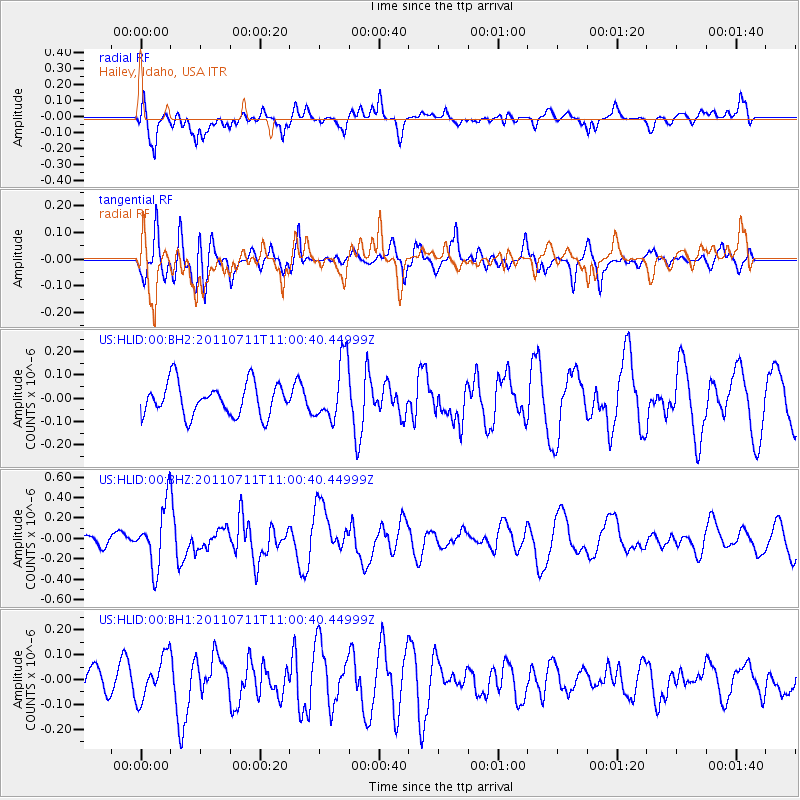
Signal To Noise
| Channel | StoN | STA | LTA |
| US:HLID:00:BHZ:20110711T11:00:40.44999Z | 5.3434796 | 3.0432955E-7 | 5.6953443E-8 |
| US:HLID:00:BH1:20110711T11:00:40.44999Z | 1.3509778 | 8.643069E-8 | 6.3976394E-8 |
| US:HLID:00:BH2:20110711T11:00:40.44999Z | 1.8472157 | 1.2823963E-7 | 6.94232E-8 |
| Arrivals |
| Ps | |
| PpPs | |
| PsPs/PpSs | |


