
INK INUVIK, N.W.T. - Earthquake Result Viewer
| ||||||||||||||||||
| ||||||||||||||||||
| ||||||||||||||||||
|
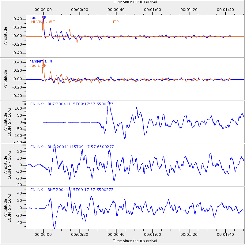
Signal To Noise
| Channel | StoN | STA | LTA |
| CN:INK: :BHN:20041115T09:17:57.650027Z | 8.438593 | 6167.936 | 730.92 |
| CN:INK: :BHE:20041115T09:17:57.650027Z | 11.684131 | 11935.651 | 1021.5267 |
| CN:INK: :BHZ:20041115T09:17:57.650027Z | 45.09032 | 33974.07 | 753.46704 |
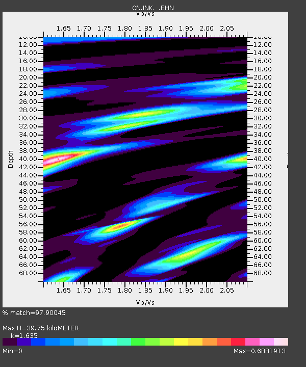
| Arrivals | |
| Ps | 4.2 SECOND |
| PpPs | 16 SECOND |
| PsPs/PpSs | 21 SECOND |

