
INK INUVIK, N.W.T. - Earthquake Result Viewer
| ||||||||||||||||||
| ||||||||||||||||||
| ||||||||||||||||||
|
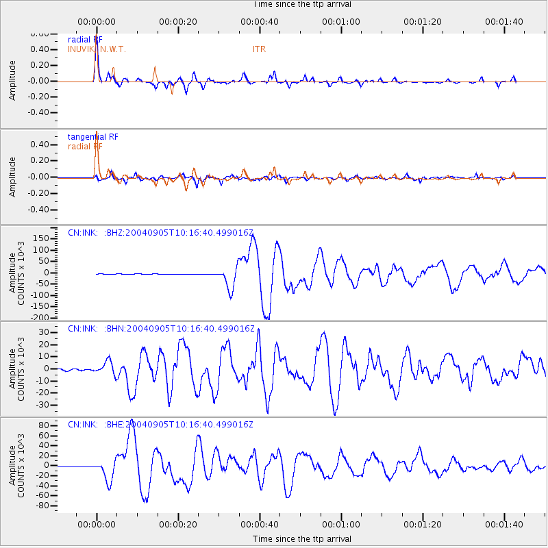
Signal To Noise
| Channel | StoN | STA | LTA |
| CN:INK: :BHN:20040905T10:16:40.499016Z | 12.542425 | 5643.5913 | 449.9601 |
| CN:INK: :BHE:20040905T10:16:40.499016Z | 51.47068 | 21759.152 | 422.7485 |
| CN:INK: :BHZ:20040905T10:16:40.499016Z | 70.95719 | 50392.84 | 710.18646 |
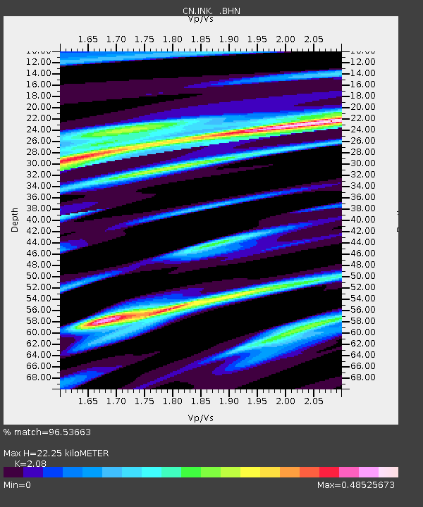
| Arrivals | |
| Ps | 4.0 SECOND |
| PpPs | 11 SECOND |
| PsPs/PpSs | 15 SECOND |

