You are here: Home > Network List > US - United States National Seismic Network Stations List
> Station HAWA Hanford, Washington, USA > Earthquake Result Viewer
HAWA Hanford, Washington, USA - Earthquake Result Viewer
*The percent match for this event was below the threshold and hence no stack was calculated.
| Earthquake location: |
West Chile Rise |
| Earthquake latitude/longitude: |
-38.2/-93.8 |
| Earthquake time(UTC): |
2011/07/14 (195) 08:49:23 GMT |
| Earthquake Depth: |
10 km |
| Earthquake Magnitude: |
5.5 MW |
| Earthquake Catalog/Contributor: |
NEIC PDE/NEIC PDE-M |
|
| Network: |
US United States National Seismic Network |
| Station: |
HAWA Hanford, Washington, USA |
| Lat/Lon: |
46.39 N/119.53 W |
| Elevation: |
364 m |
|
| Distance: |
87.4 deg |
| Az: |
342.463 deg |
| Baz: |
159.946 deg |
| Ray Param: |
$rayparam |
*The percent match for this event was below the threshold and hence was not used in the summary stack. |
|
| Radial Match: |
55.485775 % |
| Radial Bump: |
400 |
| Transverse Match: |
54.836636 % |
| Transverse Bump: |
400 |
| SOD ConfigId: |
558545 |
| Insert Time: |
2013-09-18 22:16:36.383 +0000 |
| GWidth: |
2.5 |
| Max Bumps: |
400 |
| Tol: |
0.001 |
|
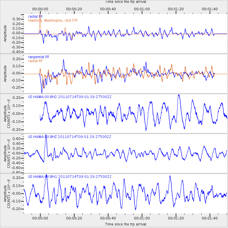
Signal To Noise
| Channel | StoN | STA | LTA |
| US:HAWA:00:BHZ:20110714T09:01:39.275002Z | 5.083838 | 3.2701266E-7 | 6.432397E-8 |
| US:HAWA:00:BH1:20110714T09:01:39.275002Z | 1.6297737 | 1.2048254E-7 | 7.3925925E-8 |
| US:HAWA:00:BH2:20110714T09:01:39.275002Z | 0.9429208 | 5.5332762E-8 | 5.8682303E-8 |
| Arrivals |
| Ps | |
| PpPs | |
| PsPs/PpSs | |


