You are here: Home > Network List > US - United States National Seismic Network Stations List
> Station DUG Dugway, Tooele County, Utah, USA > Earthquake Result Viewer
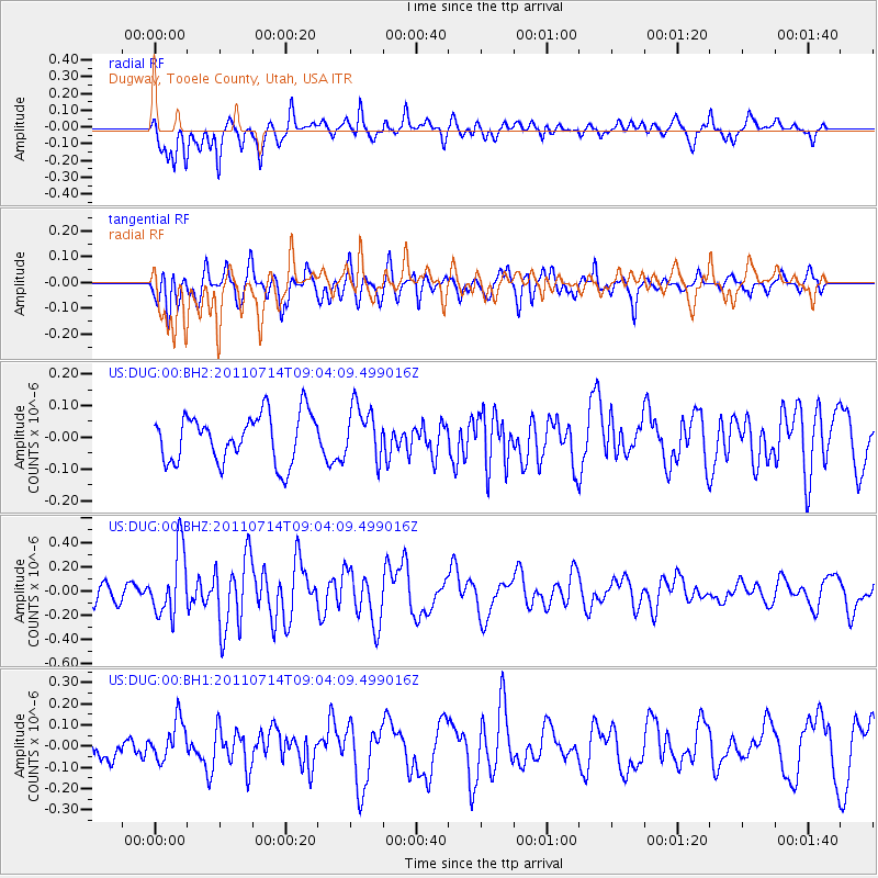
DUG Dugway, Tooele County, Utah, USA - Earthquake Result Viewer
*The percent match for this event was below the threshold and hence no stack was calculated.
| Earthquake location: |
West Chile Rise |
| Earthquake latitude/longitude: |
-38.2/-93.8 |
| Earthquake time(UTC): |
2011/07/14 (195) 08:52:31 GMT |
| Earthquake Depth: |
10 km |
| Earthquake Magnitude: |
5.5 MW |
| Earthquake Catalog/Contributor: |
NEIC PDE/NEIC PDE-M |
|
| Network: |
US United States National Seismic Network |
| Station: |
DUG Dugway, Tooele County, Utah, USA |
| Lat/Lon: |
40.19 N/112.81 W |
| Elevation: |
1477 m |
|
| Distance: |
80.0 deg |
| Az: |
345.299 deg |
| Baz: |
164.877 deg |
| Ray Param: |
$rayparam |
*The percent match for this event was below the threshold and hence was not used in the summary stack. |
|
| Radial Match: |
63.167133 % |
| Radial Bump: |
400 |
| Transverse Match: |
64.31935 % |
| Transverse Bump: |
400 |
| SOD ConfigId: |
558545 |
| Insert Time: |
2013-09-18 22:19:54.541 +0000 |
| GWidth: |
2.5 |
| Max Bumps: |
400 |
| Tol: |
0.001 |
|
Signal To Noise
| Channel | StoN | STA | LTA |
| US:DUG:00:BHZ:20110714T09:04:09.499016Z | 3.4466057 | 2.69262E-7 | 7.812382E-8 |
| US:DUG:00:BH1:20110714T09:04:09.499016Z | 1.5951943 | 9.3652616E-8 | 5.870922E-8 |
| US:DUG:00:BH2:20110714T09:04:09.499016Z | 1.1131074 | 8.4497785E-8 | 7.5911615E-8 |
| Arrivals |
| Ps | |
| PpPs | |
| PsPs/PpSs | |


