INK INUVIK, N.W.T. - Earthquake Result Viewer
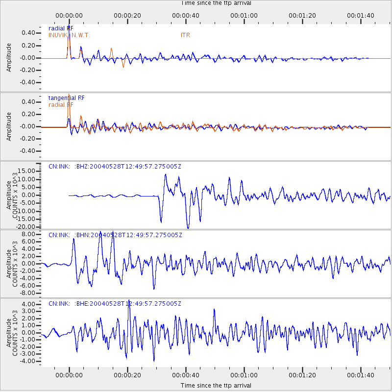
Earthquake location: Northern And Central Iran
Earthquake latitude/longitude: 36.2/51.6
Earthquake time(UTC): 2004/05/28 (149) 12:38:44 GMT
Earthquake Depth: 17 km
Earthquake Magnitude: 6.2 MB, 6.4 MS, 6.3 MW, 6.2 MW
Earthquake Catalog/Contributor: WHDF/NEIC
Network: CN Canadian National Seismograph Network
Station: INK INUVIK, N.W.T.
Lat/Lon: 68.31 N/133.52 W
Elevation: 40 m
Distance: 75.7 deg
Az: 1.971 deg
Baz: 355.712 deg
Ray Param: 0.05148638
Estimated Moho Depth: 24.75 km
Estimated Crust Vp/Vs: 1.99
Assumed Crust Vp: 6.171 km/s
Estimated Crust Vs: 3.101 km/s
Estimated Crust Poisson's Ratio: 0.33
Radial Match: 96.05693 %
Radial Bump: 323
Transverse Match: 87.07685 %
Transverse Bump: 400
SOD ConfigId: 2459
Insert Time: 2010-02-27 06:10:20.541 +0000
GWidth: 2.5
Max Bumps: 400
Tol: 0.001

Signal To Noise

ChannelStoNSTALTA
CN:INK: :BHN:20040528T12:49:57.275005Z12.0788263131.3235259.2407
CN:INK: :BHE:20040528T12:49:57.275005Z3.0711155877.04285.577
CN:INK: :BHZ:20040528T12:49:57.275005Z17.2829917366.3145426.21756
Arrivals
Ps4.1 SECOND
PpPs12 SECOND
PsPs/PpSs16 SECOND