You are here: Home > Network List > US - United States National Seismic Network Stations List
> Station HLID Hailey, Idaho, USA > Earthquake Result Viewer
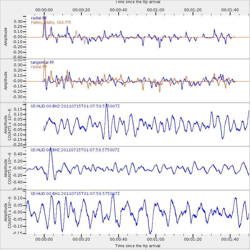
HLID Hailey, Idaho, USA - Earthquake Result Viewer
*The percent match for this event was below the threshold and hence no stack was calculated.
| Earthquake location: |
South Of Tonga Islands |
| Earthquake latitude/longitude: |
-24.2/-175.3 |
| Earthquake time(UTC): |
2011/07/15 (196) 00:55:46 GMT |
| Earthquake Depth: |
38 km |
| Earthquake Magnitude: |
5.6 MB |
| Earthquake Catalog/Contributor: |
NEIC PDE/NEIC PDE-M |
|
| Network: |
US United States National Seismic Network |
| Station: |
HLID Hailey, Idaho, USA |
| Lat/Lon: |
43.56 N/114.41 W |
| Elevation: |
1772 m |
|
| Distance: |
87.5 deg |
| Az: |
39.469 deg |
| Baz: |
232.99 deg |
| Ray Param: |
$rayparam |
*The percent match for this event was below the threshold and hence was not used in the summary stack. |
|
| Radial Match: |
63.18415 % |
| Radial Bump: |
350 |
| Transverse Match: |
48.181282 % |
| Transverse Bump: |
400 |
| SOD ConfigId: |
558545 |
| Insert Time: |
2013-09-18 22:23:08.549 +0000 |
| GWidth: |
2.5 |
| Max Bumps: |
400 |
| Tol: |
0.001 |
|
Signal To Noise
| Channel | StoN | STA | LTA |
| US:HLID:00:BHZ:20110715T01:07:59.575007Z | 7.9012218 | 2.838113E-7 | 3.5919925E-8 |
| US:HLID:00:BH1:20110715T01:07:59.575007Z | 1.519133 | 7.4701035E-8 | 4.917347E-8 |
| US:HLID:00:BH2:20110715T01:07:59.575007Z | 2.1822784 | 9.958975E-8 | 4.5635677E-8 |
| Arrivals |
| Ps | |
| PpPs | |
| PsPs/PpSs | |


