You are here: Home > Network List > US - United States National Seismic Network Stations List
> Station MVCO Mesa Verde, Colorado, USA > Earthquake Result Viewer
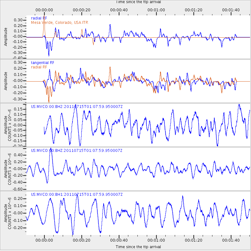
MVCO Mesa Verde, Colorado, USA - Earthquake Result Viewer
*The percent match for this event was below the threshold and hence no stack was calculated.
| Earthquake location: |
South Of Tonga Islands |
| Earthquake latitude/longitude: |
-24.2/-175.3 |
| Earthquake time(UTC): |
2011/07/15 (196) 00:55:46 GMT |
| Earthquake Depth: |
38 km |
| Earthquake Magnitude: |
5.6 MB |
| Earthquake Catalog/Contributor: |
NEIC PDE/NEIC PDE-M |
|
| Network: |
US United States National Seismic Network |
| Station: |
MVCO Mesa Verde, Colorado, USA |
| Lat/Lon: |
37.21 N/108.50 W |
| Elevation: |
2170 m |
|
| Distance: |
87.6 deg |
| Az: |
47.26 deg |
| Baz: |
237.147 deg |
| Ray Param: |
$rayparam |
*The percent match for this event was below the threshold and hence was not used in the summary stack. |
|
| Radial Match: |
74.684235 % |
| Radial Bump: |
400 |
| Transverse Match: |
57.79334 % |
| Transverse Bump: |
400 |
| SOD ConfigId: |
558545 |
| Insert Time: |
2013-09-18 22:23:24.701 +0000 |
| GWidth: |
2.5 |
| Max Bumps: |
400 |
| Tol: |
0.001 |
|
Signal To Noise
| Channel | StoN | STA | LTA |
| US:MVCO:00:BHZ:20110715T01:07:59.950007Z | 3.8477817 | 3.2341202E-7 | 8.405156E-8 |
| US:MVCO:00:BH1:20110715T01:07:59.950007Z | 1.6439471 | 1.3727848E-7 | 8.3505405E-8 |
| US:MVCO:00:BH2:20110715T01:07:59.950007Z | 0.58071405 | 5.7026543E-8 | 9.820073E-8 |
| Arrivals |
| Ps | |
| PpPs | |
| PsPs/PpSs | |


