You are here: Home > Network List > US - United States National Seismic Network Stations List
> Station MNTX Cornudas Mountains, Texas, USA > Earthquake Result Viewer
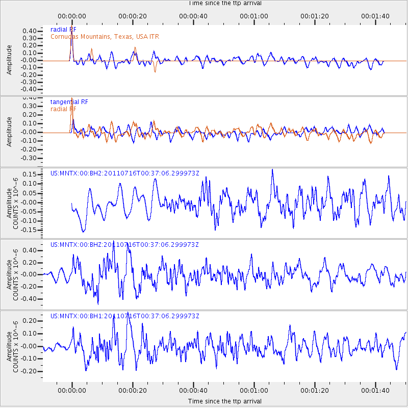
MNTX Cornudas Mountains, Texas, USA - Earthquake Result Viewer
*The percent match for this event was below the threshold and hence no stack was calculated.
| Earthquake location: |
Near Coast Of Central Chile |
| Earthquake latitude/longitude: |
-33.8/-71.8 |
| Earthquake time(UTC): |
2011/07/16 (197) 00:26:12 GMT |
| Earthquake Depth: |
20 km |
| Earthquake Magnitude: |
5.8 MB, 5.8 MS, 6.1 MW, 6.0 MW |
| Earthquake Catalog/Contributor: |
WHDF/NEIC |
|
| Network: |
US United States National Seismic Network |
| Station: |
MNTX Cornudas Mountains, Texas, USA |
| Lat/Lon: |
31.70 N/105.38 W |
| Elevation: |
404 m |
|
| Distance: |
72.4 deg |
| Az: |
330.388 deg |
| Baz: |
151.145 deg |
| Ray Param: |
$rayparam |
*The percent match for this event was below the threshold and hence was not used in the summary stack. |
|
| Radial Match: |
68.36569 % |
| Radial Bump: |
400 |
| Transverse Match: |
52.4514 % |
| Transverse Bump: |
400 |
| SOD ConfigId: |
558545 |
| Insert Time: |
2013-09-18 22:31:38.096 +0000 |
| GWidth: |
2.5 |
| Max Bumps: |
400 |
| Tol: |
0.001 |
|
Signal To Noise
| Channel | StoN | STA | LTA |
| US:MNTX:00:BHZ:20110716T00:37:06.299973Z | 3.2386675 | 1.7815586E-7 | 5.5009004E-8 |
| US:MNTX:00:BH1:20110716T00:37:06.299973Z | 1.768595 | 8.0273054E-8 | 4.5388035E-8 |
| US:MNTX:00:BH2:20110716T00:37:06.299973Z | 0.35072285 | 2.0763364E-8 | 5.920163E-8 |
| Arrivals |
| Ps | |
| PpPs | |
| PsPs/PpSs | |


