QSPA South Pole Remote Earth Science Observatory (Quiet Zone) - Earthquake Result Viewer
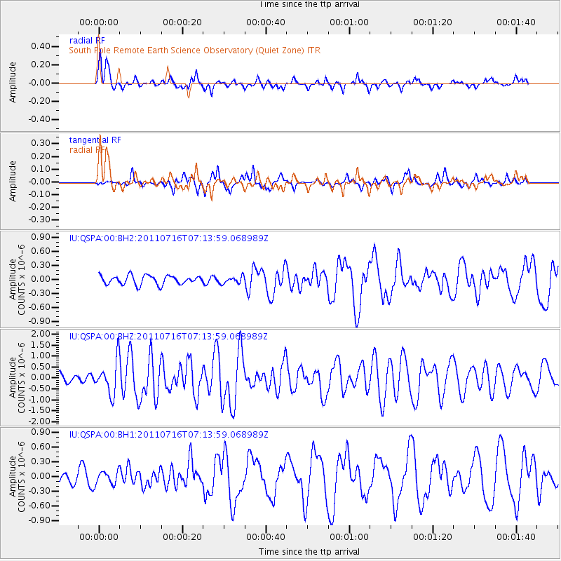
Earthquake location: Tonga Islands Region
Earthquake latitude/longitude: -22.4/-175.0
Earthquake time(UTC): 2011/07/16 (197) 07:03:32 GMT
Earthquake Depth: 7.0 km
Earthquake Magnitude: 5.7 MB, 5.6 MS, 5.8 MW, 5.7 MW
Earthquake Catalog/Contributor: WHDF/NEIC
Network: IU Global Seismograph Network (GSN - IRIS/USGS)
Station: QSPA South Pole Remote Earth Science Observatory (Quiet Zone)
Lat/Lon: 89.93 S/144.44 E
Elevation: 2850 m
Distance: 67.6 deg
Az: 180.05 deg
Baz: 40.581 deg
Ray Param: 0.056826316
Estimated Moho Depth: 21.0 km
Estimated Crust Vp/Vs: 1.61
Assumed Crust Vp: 6.193 km/s
Estimated Crust Vs: 3.859 km/s
Estimated Crust Poisson's Ratio: 0.18
Radial Match: 87.16648 %
Radial Bump: 363
Transverse Match: 79.74793 %
Transverse Bump: 400
SOD ConfigId: 558545
Insert Time: 2013-09-18 22:33:51.681 +0000
GWidth: 2.5
Max Bumps: 400
Tol: 0.001

Signal To Noise

ChannelStoNSTALTA
IU:QSPA:00:BHZ:20110716T07:13:59.068989Z2.86402637.94876E-72.7753794E-7
IU:QSPA:00:BH1:20110716T07:13:59.068989Z0.916870531.301007E-71.4189648E-7
IU:QSPA:00:BH2:20110716T07:13:59.068989Z0.780688357.490764E-89.595076E-8
Arrivals
Ps2.1 SECOND
PpPs8.5 SECOND
PsPs/PpSs11 SECOND