You are here: Home > Network List > US - United States National Seismic Network Stations List
> Station BOZ Bozeman, Montana, USA > Earthquake Result Viewer
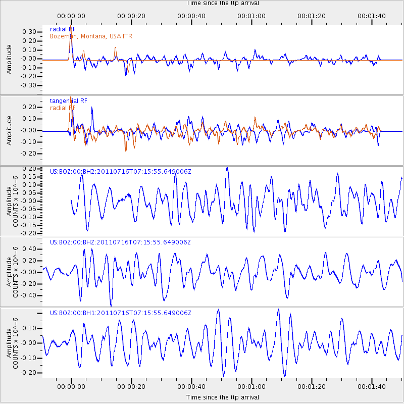
BOZ Bozeman, Montana, USA - Earthquake Result Viewer
*The percent match for this event was below the threshold and hence no stack was calculated.
| Earthquake location: |
Tonga Islands Region |
| Earthquake latitude/longitude: |
-22.4/-175.0 |
| Earthquake time(UTC): |
2011/07/16 (197) 07:03:32 GMT |
| Earthquake Depth: |
7.0 km |
| Earthquake Magnitude: |
5.7 MB, 5.6 MS, 5.8 MW, 5.7 MW |
| Earthquake Catalog/Contributor: |
WHDF/NEIC |
|
| Network: |
US United States National Seismic Network |
| Station: |
BOZ Bozeman, Montana, USA |
| Lat/Lon: |
45.65 N/111.63 W |
| Elevation: |
1589 m |
|
| Distance: |
88.8 deg |
| Az: |
38.844 deg |
| Baz: |
235.817 deg |
| Ray Param: |
$rayparam |
*The percent match for this event was below the threshold and hence was not used in the summary stack. |
|
| Radial Match: |
71.73655 % |
| Radial Bump: |
400 |
| Transverse Match: |
58.648193 % |
| Transverse Bump: |
378 |
| SOD ConfigId: |
558545 |
| Insert Time: |
2013-09-18 22:34:25.173 +0000 |
| GWidth: |
2.5 |
| Max Bumps: |
400 |
| Tol: |
0.001 |
|
Signal To Noise
| Channel | StoN | STA | LTA |
| US:BOZ:00:BHZ:20110716T07:15:55.649006Z | 4.0534887 | 2.1988458E-7 | 5.4245763E-8 |
| US:BOZ:00:BH1:20110716T07:15:55.649006Z | 1.6380316 | 9.160126E-8 | 5.5921547E-8 |
| US:BOZ:00:BH2:20110716T07:15:55.649006Z | 1.1286933 | 8.385327E-8 | 7.429234E-8 |
| Arrivals |
| Ps | |
| PpPs | |
| PsPs/PpSs | |


