You are here: Home > Network List > US - United States National Seismic Network Stations List
> Station EGMT Eagleton, Montana, USA > Earthquake Result Viewer
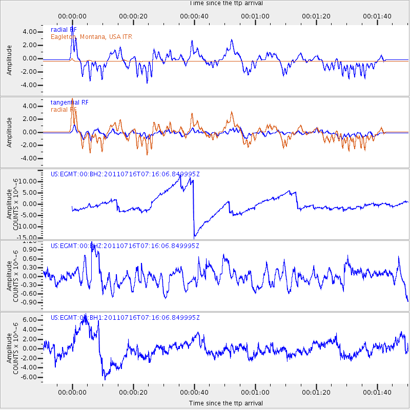
EGMT Eagleton, Montana, USA - Earthquake Result Viewer
*The percent match for this event was below the threshold and hence no stack was calculated.
| Earthquake location: |
Tonga Islands Region |
| Earthquake latitude/longitude: |
-22.4/-175.0 |
| Earthquake time(UTC): |
2011/07/16 (197) 07:03:32 GMT |
| Earthquake Depth: |
7.0 km |
| Earthquake Magnitude: |
5.7 MB, 5.6 MS, 5.8 MW, 5.7 MW |
| Earthquake Catalog/Contributor: |
WHDF/NEIC |
|
| Network: |
US United States National Seismic Network |
| Station: |
EGMT Eagleton, Montana, USA |
| Lat/Lon: |
48.02 N/109.75 W |
| Elevation: |
1055 m |
|
| Distance: |
91.2 deg |
| Az: |
37.571 deg |
| Baz: |
237.181 deg |
| Ray Param: |
$rayparam |
*The percent match for this event was below the threshold and hence was not used in the summary stack. |
|
| Radial Match: |
52.62242 % |
| Radial Bump: |
315 |
| Transverse Match: |
51.697567 % |
| Transverse Bump: |
356 |
| SOD ConfigId: |
558545 |
| Insert Time: |
2013-09-18 22:34:39.871 +0000 |
| GWidth: |
2.5 |
| Max Bumps: |
400 |
| Tol: |
0.001 |
|
Signal To Noise
| Channel | StoN | STA | LTA |
| US:EGMT:00:BHZ:20110716T07:16:06.849995Z | 1.2837521 | 3.0367156E-7 | 2.3655001E-7 |
| US:EGMT:00:BH1:20110716T07:16:06.849995Z | 3.1012135 | 4.4266153E-6 | 1.4273818E-6 |
| US:EGMT:00:BH2:20110716T07:16:06.849995Z | 5.7350893 | 8.844788E-6 | 1.5422232E-6 |
| Arrivals |
| Ps | |
| PpPs | |
| PsPs/PpSs | |


