You are here: Home > Network List > US - United States National Seismic Network Stations List
> Station NEW Newport, Washington, USA > Earthquake Result Viewer
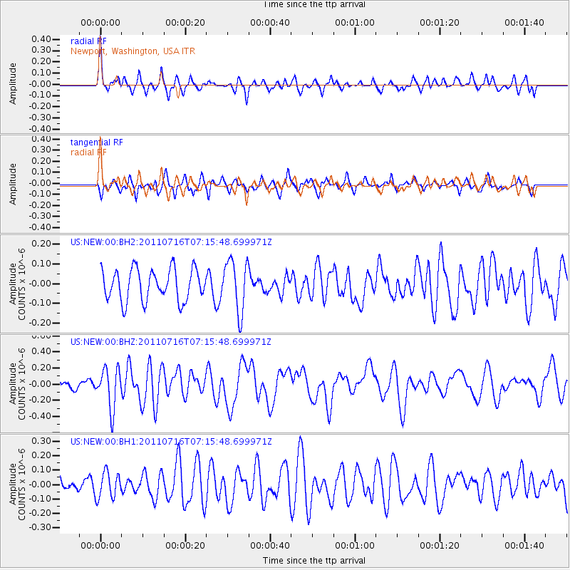
NEW Newport, Washington, USA - Earthquake Result Viewer
*The percent match for this event was below the threshold and hence no stack was calculated.
| Earthquake location: |
Tonga Islands Region |
| Earthquake latitude/longitude: |
-22.4/-175.0 |
| Earthquake time(UTC): |
2011/07/16 (197) 07:03:32 GMT |
| Earthquake Depth: |
7.0 km |
| Earthquake Magnitude: |
5.7 MB, 5.6 MS, 5.8 MW, 5.7 MW |
| Earthquake Catalog/Contributor: |
WHDF/NEIC |
|
| Network: |
US United States National Seismic Network |
| Station: |
NEW Newport, Washington, USA |
| Lat/Lon: |
48.26 N/117.12 W |
| Elevation: |
760 m |
|
| Distance: |
87.3 deg |
| Az: |
34.509 deg |
| Baz: |
231.67 deg |
| Ray Param: |
$rayparam |
*The percent match for this event was below the threshold and hence was not used in the summary stack. |
|
| Radial Match: |
66.588974 % |
| Radial Bump: |
396 |
| Transverse Match: |
60.46922 % |
| Transverse Bump: |
400 |
| SOD ConfigId: |
558545 |
| Insert Time: |
2013-09-18 22:35:09.005 +0000 |
| GWidth: |
2.5 |
| Max Bumps: |
400 |
| Tol: |
0.001 |
|
Signal To Noise
| Channel | StoN | STA | LTA |
| US:NEW:00:BHZ:20110716T07:15:48.699971Z | 3.1457675 | 2.5232367E-7 | 8.021053E-8 |
| US:NEW:00:BH1:20110716T07:15:48.699971Z | 1.805953 | 8.860943E-8 | 4.9065193E-8 |
| US:NEW:00:BH2:20110716T07:15:48.699971Z | 1.6792313 | 1.348797E-7 | 8.032229E-8 |
| Arrivals |
| Ps | |
| PpPs | |
| PsPs/PpSs | |


