You are here: Home > Network List > IU - Global Seismograph Network (GSN - IRIS/USGS) Stations List
> Station GNI Garni, Armenia > Earthquake Result Viewer
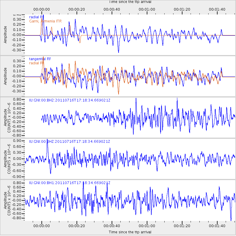
GNI Garni, Armenia - Earthquake Result Viewer
*The percent match for this event was below the threshold and hence no stack was calculated.
| Earthquake location: |
Banda Sea |
| Earthquake latitude/longitude: |
-7.1/127.6 |
| Earthquake time(UTC): |
2011/07/16 (197) 17:06:39 GMT |
| Earthquake Depth: |
255 km |
| Earthquake Magnitude: |
5.8 MB, 5.9 MW, 5.9 MW |
| Earthquake Catalog/Contributor: |
WHDF/NEIC |
|
| Network: |
IU Global Seismograph Network (GSN - IRIS/USGS) |
| Station: |
GNI Garni, Armenia |
| Lat/Lon: |
40.15 N/44.74 E |
| Elevation: |
1609 m |
|
| Distance: |
89.1 deg |
| Az: |
310.481 deg |
| Baz: |
99.999 deg |
| Ray Param: |
$rayparam |
*The percent match for this event was below the threshold and hence was not used in the summary stack. |
|
| Radial Match: |
58.553936 % |
| Radial Bump: |
400 |
| Transverse Match: |
54.144257 % |
| Transverse Bump: |
400 |
| SOD ConfigId: |
558545 |
| Insert Time: |
2013-09-18 22:36:22.163 +0000 |
| GWidth: |
2.5 |
| Max Bumps: |
400 |
| Tol: |
0.001 |
|
Signal To Noise
| Channel | StoN | STA | LTA |
| IU:GNI:00:BHZ:20110716T17:18:34.669021Z | 2.1729445 | 3.0449138E-7 | 1.4012846E-7 |
| IU:GNI:00:BH1:20110716T17:18:34.669021Z | 1.4581823 | 1.7222997E-7 | 1.1811278E-7 |
| IU:GNI:00:BH2:20110716T17:18:34.669021Z | 0.6981293 | 9.690645E-8 | 1.3880874E-7 |
| Arrivals |
| Ps | |
| PpPs | |
| PsPs/PpSs | |


