You are here: Home > Network List > II - Global Seismograph Network (GSN - IRIS/IDA) Stations List
> Station WRAB Tennant Creek, NT, Australia > Earthquake Result Viewer
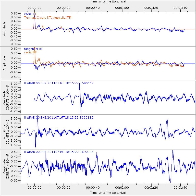
WRAB Tennant Creek, NT, Australia - Earthquake Result Viewer
*The percent match for this event was below the threshold and hence no stack was calculated.
| Earthquake location: |
Vanuatu Islands |
| Earthquake latitude/longitude: |
-18.9/169.4 |
| Earthquake time(UTC): |
2011/07/16 (197) 18:09:40 GMT |
| Earthquake Depth: |
246 km |
| Earthquake Magnitude: |
5.5 MB, 5.7 MW, 5.6 MW |
| Earthquake Catalog/Contributor: |
WHDF/NEIC |
|
| Network: |
II Global Seismograph Network (GSN - IRIS/IDA) |
| Station: |
WRAB Tennant Creek, NT, Australia |
| Lat/Lon: |
19.93 S/134.36 E |
| Elevation: |
366 m |
|
| Distance: |
33.0 deg |
| Az: |
262.274 deg |
| Baz: |
94.163 deg |
| Ray Param: |
$rayparam |
*The percent match for this event was below the threshold and hence was not used in the summary stack. |
|
| Radial Match: |
58.194473 % |
| Radial Bump: |
400 |
| Transverse Match: |
59.075356 % |
| Transverse Bump: |
323 |
| SOD ConfigId: |
558545 |
| Insert Time: |
2013-09-18 22:37:49.559 +0000 |
| GWidth: |
2.5 |
| Max Bumps: |
400 |
| Tol: |
0.001 |
|
Signal To Noise
| Channel | StoN | STA | LTA |
| II:WRAB:00:BHZ:20110716T18:15:22.369011Z | 4.176652 | 6.5287793E-7 | 1.5631609E-7 |
| II:WRAB:00:BH1:20110716T18:15:22.369011Z | 1.0459092 | 1.10419116E-7 | 1.05572376E-7 |
| II:WRAB:00:BH2:20110716T18:15:22.369011Z | 2.7134528 | 5.1336906E-7 | 1.8919403E-7 |
| Arrivals |
| Ps | |
| PpPs | |
| PsPs/PpSs | |


