You are here: Home > Network List > US - United States National Seismic Network Stations List
> Station DUG Dugway, Tooele County, Utah, USA > Earthquake Result Viewer
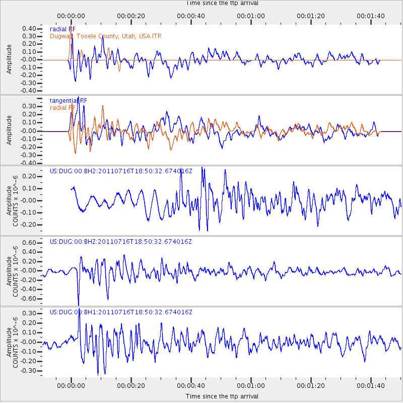
DUG Dugway, Tooele County, Utah, USA - Earthquake Result Viewer
*The percent match for this event was below the threshold and hence no stack was calculated.
| Earthquake location: |
Lake Baykal Region, Russia |
| Earthquake latitude/longitude: |
52.9/108.4 |
| Earthquake time(UTC): |
2011/07/16 (197) 18:38:50 GMT |
| Earthquake Depth: |
8.5 km |
| Earthquake Magnitude: |
5.5 MB, 5.3 MW, 5.3 MW |
| Earthquake Catalog/Contributor: |
WHDF/NEIC |
|
| Network: |
US United States National Seismic Network |
| Station: |
DUG Dugway, Tooele County, Utah, USA |
| Lat/Lon: |
40.19 N/112.81 W |
| Elevation: |
1477 m |
|
| Distance: |
80.7 deg |
| Az: |
30.789 deg |
| Baz: |
336.109 deg |
| Ray Param: |
$rayparam |
*The percent match for this event was below the threshold and hence was not used in the summary stack. |
|
| Radial Match: |
68.60931 % |
| Radial Bump: |
400 |
| Transverse Match: |
62.961124 % |
| Transverse Bump: |
400 |
| SOD ConfigId: |
558545 |
| Insert Time: |
2013-09-18 22:41:05.635 +0000 |
| GWidth: |
2.5 |
| Max Bumps: |
400 |
| Tol: |
0.001 |
|
Signal To Noise
| Channel | StoN | STA | LTA |
| US:DUG:00:BHZ:20110716T18:50:32.674016Z | 3.3813176 | 2.1671252E-7 | 6.409115E-8 |
| US:DUG:00:BH1:20110716T18:50:32.674016Z | 3.5266042 | 1.310971E-7 | 3.7173752E-8 |
| US:DUG:00:BH2:20110716T18:50:32.674016Z | 2.0836904 | 1.0463968E-7 | 5.021844E-8 |
| Arrivals |
| Ps | |
| PpPs | |
| PsPs/PpSs | |


