You are here: Home > Network List > US - United States National Seismic Network Stations List
> Station HAWA Hanford, Washington, USA > Earthquake Result Viewer
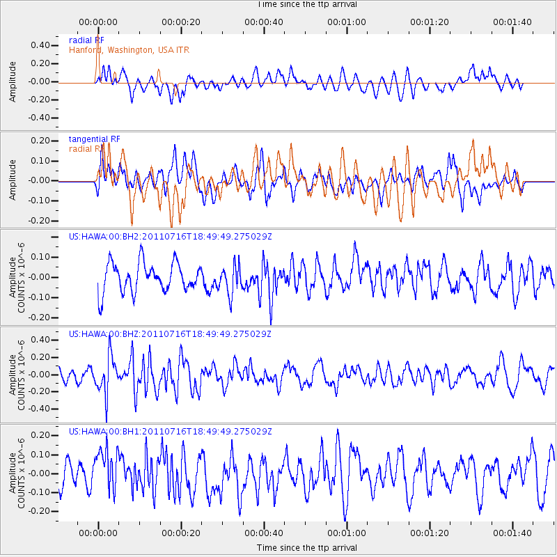
HAWA Hanford, Washington, USA - Earthquake Result Viewer
*The percent match for this event was below the threshold and hence no stack was calculated.
| Earthquake location: |
Lake Baykal Region, Russia |
| Earthquake latitude/longitude: |
52.9/108.4 |
| Earthquake time(UTC): |
2011/07/16 (197) 18:38:50 GMT |
| Earthquake Depth: |
8.5 km |
| Earthquake Magnitude: |
5.5 MB, 5.3 MW, 5.3 MW |
| Earthquake Catalog/Contributor: |
WHDF/NEIC |
|
| Network: |
US United States National Seismic Network |
| Station: |
HAWA Hanford, Washington, USA |
| Lat/Lon: |
46.39 N/119.53 W |
| Elevation: |
364 m |
|
| Distance: |
72.9 deg |
| Az: |
32.533 deg |
| Baz: |
331.908 deg |
| Ray Param: |
$rayparam |
*The percent match for this event was below the threshold and hence was not used in the summary stack. |
|
| Radial Match: |
52.51079 % |
| Radial Bump: |
400 |
| Transverse Match: |
70.01105 % |
| Transverse Bump: |
400 |
| SOD ConfigId: |
558545 |
| Insert Time: |
2013-09-18 22:41:21.146 +0000 |
| GWidth: |
2.5 |
| Max Bumps: |
400 |
| Tol: |
0.001 |
|
Signal To Noise
| Channel | StoN | STA | LTA |
| US:HAWA:00:BHZ:20110716T18:49:49.275029Z | 2.8971648 | 2.2017771E-7 | 7.5997654E-8 |
| US:HAWA:00:BH1:20110716T18:49:49.275029Z | 1.9476563 | 1.083523E-7 | 5.563215E-8 |
| US:HAWA:00:BH2:20110716T18:49:49.275029Z | 0.9813159 | 6.957941E-8 | 7.0904186E-8 |
| Arrivals |
| Ps | |
| PpPs | |
| PsPs/PpSs | |


