You are here: Home > Network List > US - United States National Seismic Network Stations List
> Station AMTX Amarillo, Texas, USA > Earthquake Result Viewer
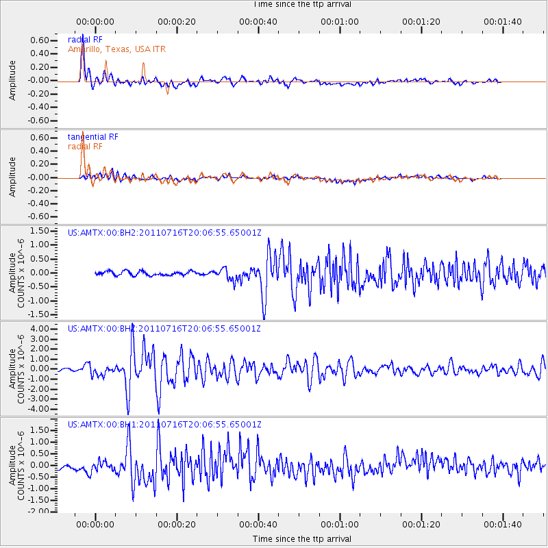
AMTX Amarillo, Texas, USA - Earthquake Result Viewer
*The percent match for this event was below the threshold and hence no stack was calculated.
| Earthquake location: |
Alaska Peninsula |
| Earthquake latitude/longitude: |
54.8/-161.3 |
| Earthquake time(UTC): |
2011/07/16 (197) 19:59:12 GMT |
| Earthquake Depth: |
36 km |
| Earthquake Magnitude: |
6.3 MB, 5.9 MS, 6.2 MW, 6.1 MW |
| Earthquake Catalog/Contributor: |
WHDF/NEIC |
|
| Network: |
US United States National Seismic Network |
| Station: |
AMTX Amarillo, Texas, USA |
| Lat/Lon: |
34.53 N/101.41 W |
| Elevation: |
1010 m |
|
| Distance: |
45.6 deg |
| Az: |
90.874 deg |
| Baz: |
315.455 deg |
| Ray Param: |
$rayparam |
*The percent match for this event was below the threshold and hence was not used in the summary stack. |
|
| Radial Match: |
88.91741 % |
| Radial Bump: |
400 |
| Transverse Match: |
58.73826 % |
| Transverse Bump: |
400 |
| SOD ConfigId: |
558545 |
| Insert Time: |
2013-09-18 22:44:54.099 +0000 |
| GWidth: |
2.5 |
| Max Bumps: |
400 |
| Tol: |
0.001 |
|
Signal To Noise
| Channel | StoN | STA | LTA |
| US:AMTX:00:BHZ:20110716T20:06:55.65001Z | 5.0440087 | 4.6194253E-7 | 9.158242E-8 |
| US:AMTX:00:BH1:20110716T20:06:55.65001Z | 1.4618322 | 1.9536263E-7 | 1.3364232E-7 |
| US:AMTX:00:BH2:20110716T20:06:55.65001Z | 3.1855938 | 2.264375E-7 | 7.108173E-8 |
| Arrivals |
| Ps | |
| PpPs | |
| PsPs/PpSs | |


