You are here: Home > Network List > IU - Global Seismograph Network (GSN - IRIS/USGS) Stations List
> Station GNI Garni, Armenia > Earthquake Result Viewer
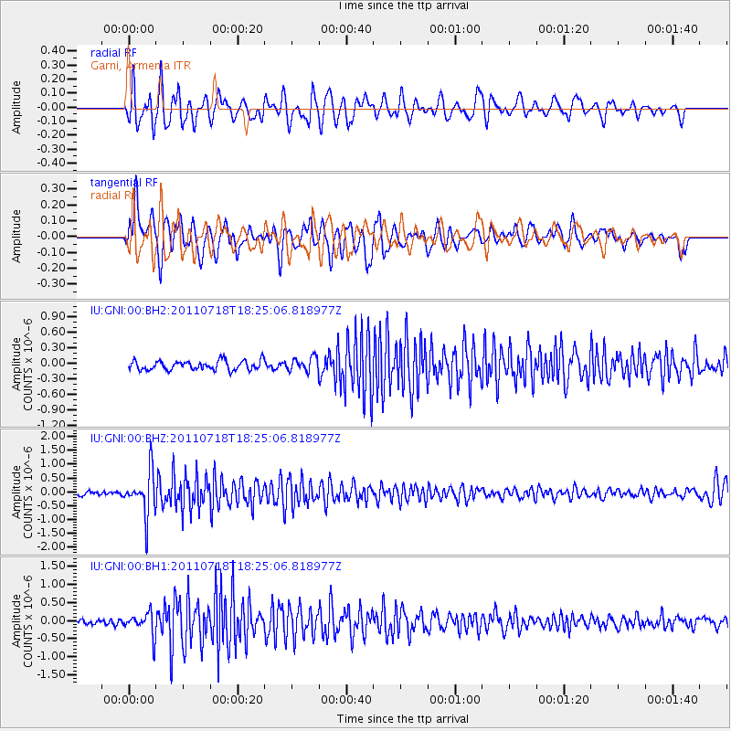
GNI Garni, Armenia - Earthquake Result Viewer
*The percent match for this event was below the threshold and hence no stack was calculated.
| Earthquake location: |
Northwest Of Kuril Islands |
| Earthquake latitude/longitude: |
52.8/152.9 |
| Earthquake time(UTC): |
2011/07/18 (199) 18:15:24 GMT |
| Earthquake Depth: |
494 km |
| Earthquake Magnitude: |
5.5 MW |
| Earthquake Catalog/Contributor: |
NEIC PDE/NEIC PDE-M |
|
| Network: |
IU Global Seismograph Network (GSN - IRIS/USGS) |
| Station: |
GNI Garni, Armenia |
| Lat/Lon: |
40.15 N/44.74 E |
| Elevation: |
1609 m |
|
| Distance: |
68.6 deg |
| Az: |
308.548 deg |
| Baz: |
38.279 deg |
| Ray Param: |
$rayparam |
*The percent match for this event was below the threshold and hence was not used in the summary stack. |
|
| Radial Match: |
54.847908 % |
| Radial Bump: |
400 |
| Transverse Match: |
51.63841 % |
| Transverse Bump: |
400 |
| SOD ConfigId: |
558545 |
| Insert Time: |
2013-09-18 22:48:00.584 +0000 |
| GWidth: |
2.5 |
| Max Bumps: |
400 |
| Tol: |
0.001 |
|
Signal To Noise
| Channel | StoN | STA | LTA |
| IU:GNI:00:BHZ:20110718T18:25:06.818977Z | 11.380239 | 7.8253106E-7 | 6.876227E-8 |
| IU:GNI:00:BH1:20110718T18:25:06.818977Z | 4.8488164 | 3.2396957E-7 | 6.681415E-8 |
| IU:GNI:00:BH2:20110718T18:25:06.818977Z | 1.4765252 | 1.3313395E-7 | 9.016707E-8 |
| Arrivals |
| Ps | |
| PpPs | |
| PsPs/PpSs | |


