You are here: Home > Network List > IU - Global Seismograph Network (GSN - IRIS/USGS) Stations List
> Station RSSD Black Hills, South Dakota, USA > Earthquake Result Viewer
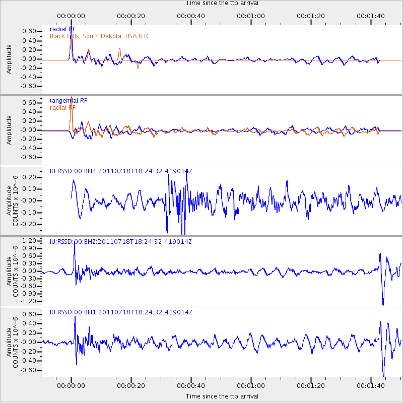
RSSD Black Hills, South Dakota, USA - Earthquake Result Viewer
*The percent match for this event was below the threshold and hence no stack was calculated.
| Earthquake location: |
Northwest Of Kuril Islands |
| Earthquake latitude/longitude: |
52.8/152.9 |
| Earthquake time(UTC): |
2011/07/18 (199) 18:15:24 GMT |
| Earthquake Depth: |
494 km |
| Earthquake Magnitude: |
5.5 MW |
| Earthquake Catalog/Contributor: |
NEIC PDE/NEIC PDE-M |
|
| Network: |
IU Global Seismograph Network (GSN - IRIS/USGS) |
| Station: |
RSSD Black Hills, South Dakota, USA |
| Lat/Lon: |
44.12 N/104.04 W |
| Elevation: |
2090 m |
|
| Distance: |
63.1 deg |
| Az: |
51.902 deg |
| Baz: |
318.437 deg |
| Ray Param: |
$rayparam |
*The percent match for this event was below the threshold and hence was not used in the summary stack. |
|
| Radial Match: |
63.03414 % |
| Radial Bump: |
393 |
| Transverse Match: |
60.126675 % |
| Transverse Bump: |
400 |
| SOD ConfigId: |
558545 |
| Insert Time: |
2013-09-18 22:48:24.003 +0000 |
| GWidth: |
2.5 |
| Max Bumps: |
400 |
| Tol: |
0.001 |
|
Signal To Noise
| Channel | StoN | STA | LTA |
| IU:RSSD:00:BHZ:20110718T18:24:32.419014Z | 5.6452827 | 3.0358126E-7 | 5.3776095E-8 |
| IU:RSSD:00:BH1:20110718T18:24:32.419014Z | 3.391845 | 1.8057803E-7 | 5.3238878E-8 |
| IU:RSSD:00:BH2:20110718T18:24:32.419014Z | 1.6865574 | 1.02783545E-7 | 6.094281E-8 |
| Arrivals |
| Ps | |
| PpPs | |
| PsPs/PpSs | |


