
INK INUVIK, NT, CANADA.ANADA - Earthquake Result Viewer
| ||||||||||||||||||
| ||||||||||||||||||
| ||||||||||||||||||
|
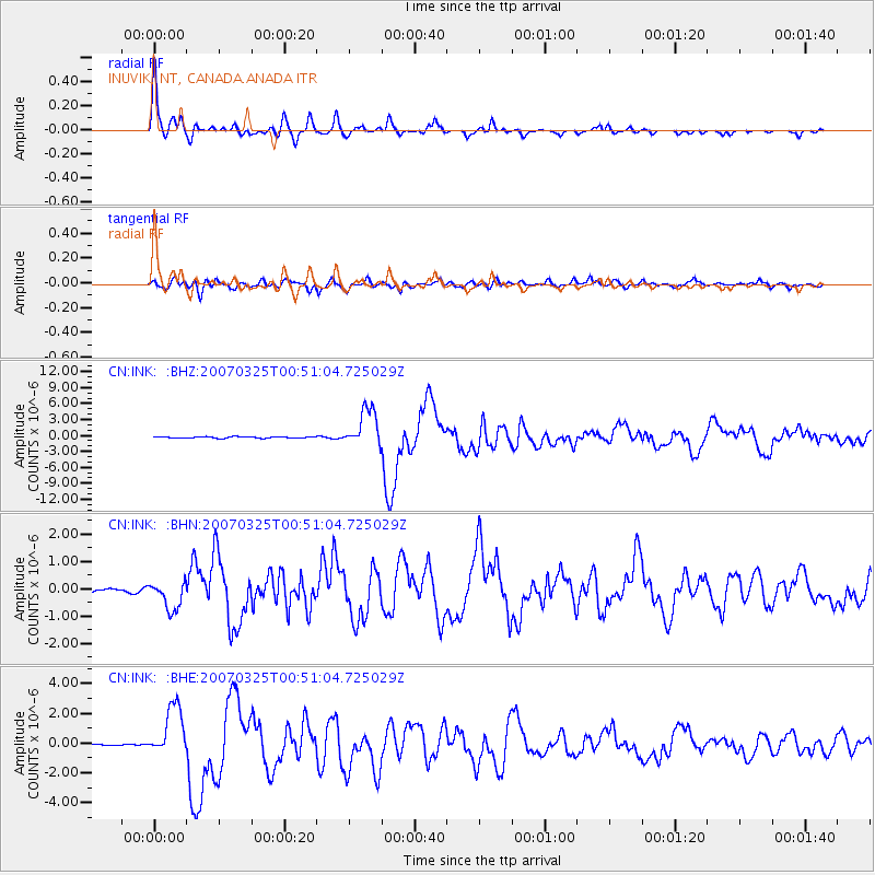
Signal To Noise
| Channel | StoN | STA | LTA |
| CN:INK: :BHN:20070325T00:51:04.725029Z | 7.504104 | 5.198652E-7 | 6.927744E-8 |
| CN:INK: :BHE:20070325T00:51:04.725029Z | 26.11711 | 1.7391195E-6 | 6.658928E-8 |
| CN:INK: :BHZ:20070325T00:51:04.725029Z | 28.993683 | 3.593336E-6 | 1.2393514E-7 |
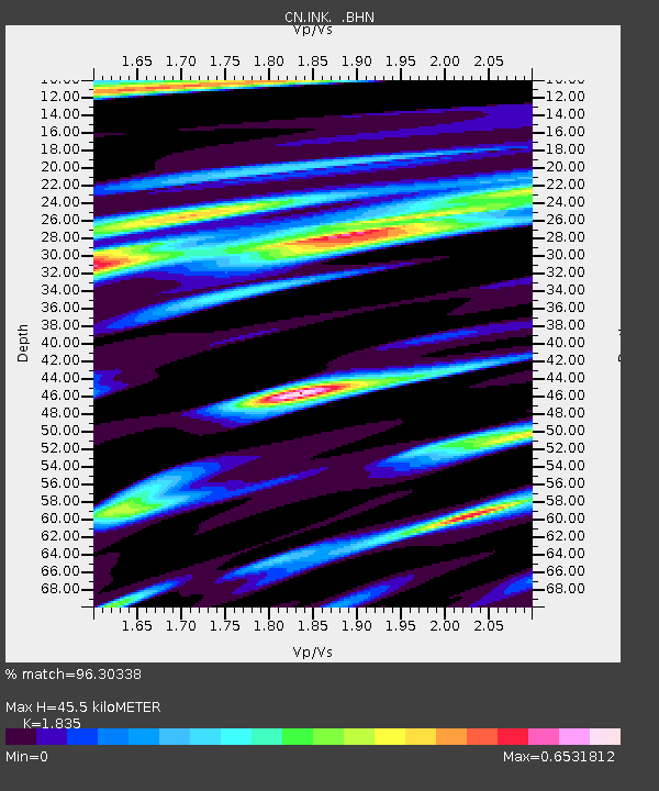
| Arrivals | |
| Ps | 6.4 SECOND |
| PpPs | 20 SECOND |
| PsPs/PpSs | 26 SECOND |

