You are here: Home > Network List > US - United States National Seismic Network Stations List
> Station OGNE Ogallala, Nebraska, USA > Earthquake Result Viewer
OGNE Ogallala, Nebraska, USA - Earthquake Result Viewer
*The percent match for this event was below the threshold and hence no stack was calculated.
| Earthquake location: |
Northwest Of Kuril Islands |
| Earthquake latitude/longitude: |
52.8/152.9 |
| Earthquake time(UTC): |
2011/07/18 (199) 18:15:24 GMT |
| Earthquake Depth: |
494 km |
| Earthquake Magnitude: |
5.5 MW |
| Earthquake Catalog/Contributor: |
NEIC PDE/NEIC PDE-M |
|
| Network: |
US United States National Seismic Network |
| Station: |
OGNE Ogallala, Nebraska, USA |
| Lat/Lon: |
40.95 N/102.03 W |
| Elevation: |
0.0 m |
|
| Distance: |
66.5 deg |
| Az: |
52.947 deg |
| Baz: |
320.233 deg |
| Ray Param: |
$rayparam |
*The percent match for this event was below the threshold and hence was not used in the summary stack. |
|
| Radial Match: |
56.57319 % |
| Radial Bump: |
400 |
| Transverse Match: |
59.66516 % |
| Transverse Bump: |
400 |
| SOD ConfigId: |
558545 |
| Insert Time: |
2013-09-18 22:50:05.278 +0000 |
| GWidth: |
2.5 |
| Max Bumps: |
400 |
| Tol: |
0.001 |
|
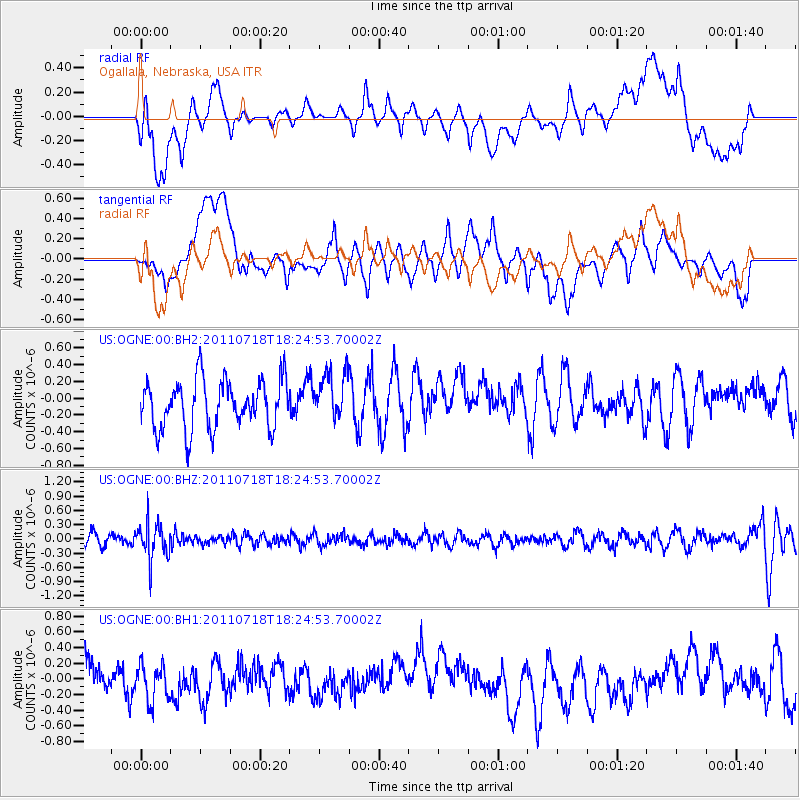
Signal To Noise
| Channel | StoN | STA | LTA |
| US:OGNE:00:BHZ:20110718T18:24:53.70002Z | 3.1720731 | 3.908315E-7 | 1.2321011E-7 |
| US:OGNE:00:BH1:20110718T18:24:53.70002Z | 1.1450766 | 2.355017E-7 | 2.0566459E-7 |
| US:OGNE:00:BH2:20110718T18:24:53.70002Z | 1.026375 | 2.9591882E-7 | 2.883145E-7 |
| Arrivals |
| Ps | |
| PpPs | |
| PsPs/PpSs | |


