You are here: Home > Network List > US - United States National Seismic Network Stations List
> Station BLA Blacksburg, Virginia, USA > Earthquake Result Viewer
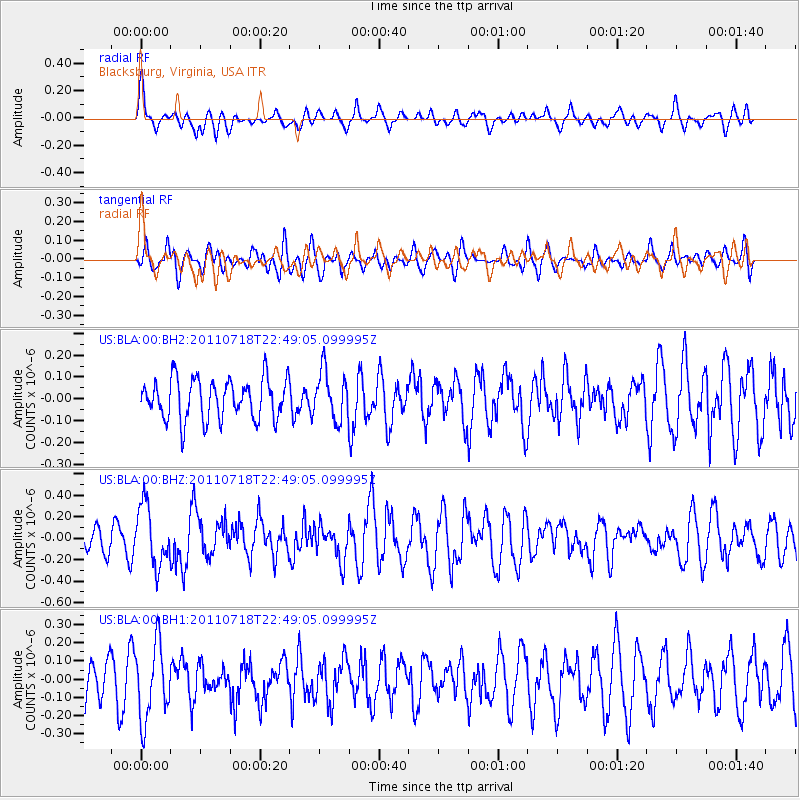
BLA Blacksburg, Virginia, USA - Earthquake Result Viewer
*The percent match for this event was below the threshold and hence no stack was calculated.
| Earthquake location: |
Rat Islands, Aleutian Islands |
| Earthquake latitude/longitude: |
51.3/178.9 |
| Earthquake time(UTC): |
2011/07/18 (199) 22:38:38 GMT |
| Earthquake Depth: |
19 km |
| Earthquake Magnitude: |
5.8 MW, 5.3 MS, 5.4 MB, 5.8 MW |
| Earthquake Catalog/Contributor: |
WHDF/NEIC |
|
| Network: |
US United States National Seismic Network |
| Station: |
BLA Blacksburg, Virginia, USA |
| Lat/Lon: |
37.21 N/80.42 W |
| Elevation: |
634 m |
|
| Distance: |
67.9 deg |
| Az: |
57.866 deg |
| Baz: |
318.227 deg |
| Ray Param: |
$rayparam |
*The percent match for this event was below the threshold and hence was not used in the summary stack. |
|
| Radial Match: |
54.635937 % |
| Radial Bump: |
400 |
| Transverse Match: |
67.7535 % |
| Transverse Bump: |
400 |
| SOD ConfigId: |
558545 |
| Insert Time: |
2013-09-18 22:52:28.188 +0000 |
| GWidth: |
2.5 |
| Max Bumps: |
400 |
| Tol: |
0.001 |
|
Signal To Noise
| Channel | StoN | STA | LTA |
| US:BLA:00:BHZ:20110718T22:49:05.099995Z | 3.2052794 | 2.7728655E-7 | 8.650932E-8 |
| US:BLA:00:BH1:20110718T22:49:05.099995Z | 2.5244923 | 2.046614E-7 | 8.1070326E-8 |
| US:BLA:00:BH2:20110718T22:49:05.099995Z | 1.1877723 | 1.0910066E-7 | 9.185318E-8 |
| Arrivals |
| Ps | |
| PpPs | |
| PsPs/PpSs | |


