You are here: Home > Network List > US - United States National Seismic Network Stations List
> Station WMOK Wichita Mountains, Oklahoma, USA > Earthquake Result Viewer
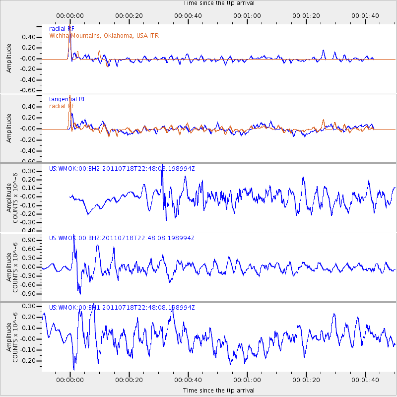
WMOK Wichita Mountains, Oklahoma, USA - Earthquake Result Viewer
*The percent match for this event was below the threshold and hence no stack was calculated.
| Earthquake location: |
Rat Islands, Aleutian Islands |
| Earthquake latitude/longitude: |
51.3/178.9 |
| Earthquake time(UTC): |
2011/07/18 (199) 22:38:38 GMT |
| Earthquake Depth: |
19 km |
| Earthquake Magnitude: |
5.8 MW, 5.3 MS, 5.4 MB, 5.8 MW |
| Earthquake Catalog/Contributor: |
WHDF/NEIC |
|
| Network: |
US United States National Seismic Network |
| Station: |
WMOK Wichita Mountains, Oklahoma, USA |
| Lat/Lon: |
34.74 N/98.78 W |
| Elevation: |
486 m |
|
| Distance: |
59.3 deg |
| Az: |
71.685 deg |
| Baz: |
313.614 deg |
| Ray Param: |
$rayparam |
*The percent match for this event was below the threshold and hence was not used in the summary stack. |
|
| Radial Match: |
55.855804 % |
| Radial Bump: |
400 |
| Transverse Match: |
20.892607 % |
| Transverse Bump: |
400 |
| SOD ConfigId: |
558545 |
| Insert Time: |
2013-09-18 22:54:08.628 +0000 |
| GWidth: |
2.5 |
| Max Bumps: |
400 |
| Tol: |
0.001 |
|
Signal To Noise
| Channel | StoN | STA | LTA |
| US:WMOK:00:BHZ:20110718T22:48:08.198994Z | 8.780359 | 4.8091186E-7 | 5.4771316E-8 |
| US:WMOK:00:BH1:20110718T22:48:08.198994Z | 1.0193527 | 2.1477292E-7 | 2.1069542E-7 |
| US:WMOK:00:BH2:20110718T22:48:08.198994Z | 2.1157281 | 1.4271616E-7 | 6.745487E-8 |
| Arrivals |
| Ps | |
| PpPs | |
| PsPs/PpSs | |


