You are here: Home > Network List > US - United States National Seismic Network Stations List
> Station LAO LASA Array, Montana, USA > Earthquake Result Viewer
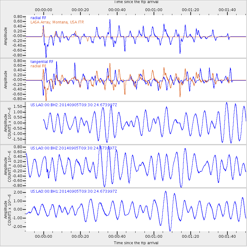
LAO LASA Array, Montana, USA - Earthquake Result Viewer
*The percent match for this event was below the threshold and hence no stack was calculated.
| Earthquake location: |
Easter Island Region |
| Earthquake latitude/longitude: |
-26.7/-114.5 |
| Earthquake time(UTC): |
2014/09/05 (248) 09:19:23 GMT |
| Earthquake Depth: |
10 km |
| Earthquake Magnitude: |
4.9 MW |
| Earthquake Catalog/Contributor: |
ISC/ISC |
|
| Network: |
US United States National Seismic Network |
| Station: |
LAO LASA Array, Montana, USA |
| Lat/Lon: |
46.69 N/106.22 W |
| Elevation: |
902 m |
|
| Distance: |
73.4 deg |
| Az: |
5.905 deg |
| Baz: |
187.685 deg |
| Ray Param: |
$rayparam |
*The percent match for this event was below the threshold and hence was not used in the summary stack. |
|
| Radial Match: |
53.529396 % |
| Radial Bump: |
400 |
| Transverse Match: |
66.84302 % |
| Transverse Bump: |
342 |
| SOD ConfigId: |
3390531 |
| Insert Time: |
2019-04-13 21:02:56.726 +0000 |
| GWidth: |
2.5 |
| Max Bumps: |
400 |
| Tol: |
0.001 |
|
Signal To Noise
| Channel | StoN | STA | LTA |
| US:LAO:00:BHZ:20140905T09:30:24.673997Z | 1.2210963 | 2.944334E-7 | 2.4112217E-7 |
| US:LAO:00:BH1:20140905T09:30:24.673997Z | 0.52467924 | 4.936625E-7 | 9.408845E-7 |
| US:LAO:00:BH2:20140905T09:30:24.673997Z | 2.347067 | 1.1862464E-6 | 5.054165E-7 |
| Arrivals |
| Ps | |
| PpPs | |
| PsPs/PpSs | |


