You are here: Home > Network List > US - United States National Seismic Network Stations List
> Station WUAZ Wupatki, Arizona, USA > Earthquake Result Viewer
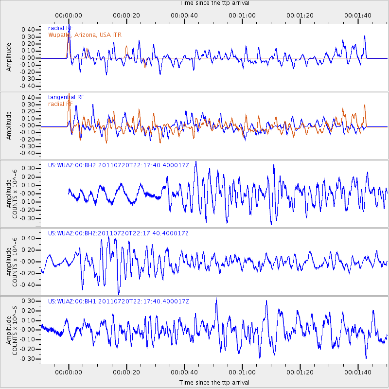
WUAZ Wupatki, Arizona, USA - Earthquake Result Viewer
*The percent match for this event was below the threshold and hence no stack was calculated.
| Earthquake location: |
Solomon Islands |
| Earthquake latitude/longitude: |
-10.3/162.0 |
| Earthquake time(UTC): |
2011/07/20 (201) 22:04:59 GMT |
| Earthquake Depth: |
21 km |
| Earthquake Magnitude: |
5.9 MB, 5.6 MS, 6.0 MW, 6.0 MW |
| Earthquake Catalog/Contributor: |
WHDF/NEIC |
|
| Network: |
US United States National Seismic Network |
| Station: |
WUAZ Wupatki, Arizona, USA |
| Lat/Lon: |
35.52 N/111.37 W |
| Elevation: |
1592 m |
|
| Distance: |
93.2 deg |
| Az: |
54.65 deg |
| Baz: |
259.668 deg |
| Ray Param: |
$rayparam |
*The percent match for this event was below the threshold and hence was not used in the summary stack. |
|
| Radial Match: |
78.02044 % |
| Radial Bump: |
400 |
| Transverse Match: |
66.76285 % |
| Transverse Bump: |
400 |
| SOD ConfigId: |
558545 |
| Insert Time: |
2013-09-18 23:00:02.427 +0000 |
| GWidth: |
2.5 |
| Max Bumps: |
400 |
| Tol: |
0.001 |
|
Signal To Noise
| Channel | StoN | STA | LTA |
| US:WUAZ:00:BHZ:20110720T22:17:40.400017Z | 1.7958955 | 1.5259819E-7 | 8.497053E-8 |
| US:WUAZ:00:BH1:20110720T22:17:40.400017Z | 0.7977705 | 5.797889E-8 | 7.267616E-8 |
| US:WUAZ:00:BH2:20110720T22:17:40.400017Z | 1.3203439 | 8.668771E-8 | 6.5655406E-8 |
| Arrivals |
| Ps | |
| PpPs | |
| PsPs/PpSs | |


