You are here: Home > Network List > IU - Global Seismograph Network (GSN - IRIS/USGS) Stations List
> Station GUMO Guam, Mariana Islands > Earthquake Result Viewer
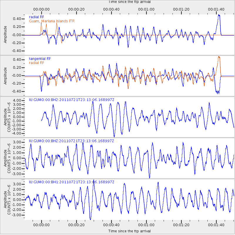
GUMO Guam, Mariana Islands - Earthquake Result Viewer
*The percent match for this event was below the threshold and hence no stack was calculated.
| Earthquake location: |
Balleny Islands Region |
| Earthquake latitude/longitude: |
-62.5/164.5 |
| Earthquake time(UTC): |
2011/07/21 (202) 23:01:42 GMT |
| Earthquake Depth: |
10 km |
| Earthquake Magnitude: |
6.0 MW, 5.5 MS, 5.6 MB, 5.8 MW |
| Earthquake Catalog/Contributor: |
NEIC PDE/NEIC PDE-M |
|
| Network: |
IU Global Seismograph Network (GSN - IRIS/USGS) |
| Station: |
GUMO Guam, Mariana Islands |
| Lat/Lon: |
13.59 N/144.87 E |
| Elevation: |
170 m |
|
| Distance: |
77.4 deg |
| Az: |
340.489 deg |
| Baz: |
170.824 deg |
| Ray Param: |
$rayparam |
*The percent match for this event was below the threshold and hence was not used in the summary stack. |
|
| Radial Match: |
61.834225 % |
| Radial Bump: |
400 |
| Transverse Match: |
54.564034 % |
| Transverse Bump: |
400 |
| SOD ConfigId: |
558545 |
| Insert Time: |
2013-09-18 23:00:50.579 +0000 |
| GWidth: |
2.5 |
| Max Bumps: |
400 |
| Tol: |
0.001 |
|
Signal To Noise
| Channel | StoN | STA | LTA |
| IU:GUMO:00:BHZ:20110721T23:13:06.168997Z | 1.0291529 | 1.1313258E-6 | 1.0992786E-6 |
| IU:GUMO:00:BH1:20110721T23:13:06.168997Z | 0.9411829 | 1.0665586E-6 | 1.1332107E-6 |
| IU:GUMO:00:BH2:20110721T23:13:06.168997Z | 2.2564278 | 2.626497E-6 | 1.1640067E-6 |
| Arrivals |
| Ps | |
| PpPs | |
| PsPs/PpSs | |


