You are here: Home > Network List > IU - Global Seismograph Network (GSN - IRIS/USGS) Stations List
> Station HNR Honiara, Solomon Islands > Earthquake Result Viewer
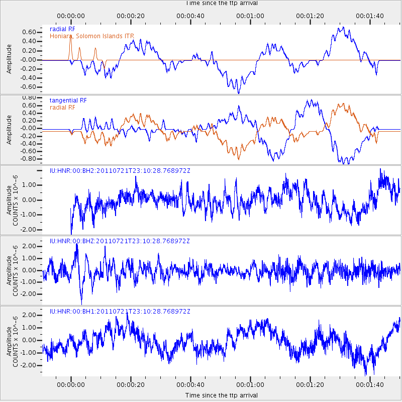
HNR Honiara, Solomon Islands - Earthquake Result Viewer
*The percent match for this event was below the threshold and hence no stack was calculated.
| Earthquake location: |
Balleny Islands Region |
| Earthquake latitude/longitude: |
-62.5/164.5 |
| Earthquake time(UTC): |
2011/07/21 (202) 23:01:42 GMT |
| Earthquake Depth: |
10 km |
| Earthquake Magnitude: |
6.0 MW, 5.5 MS, 5.6 MB, 5.8 MW |
| Earthquake Catalog/Contributor: |
NEIC PDE/NEIC PDE-M |
|
| Network: |
IU Global Seismograph Network (GSN - IRIS/USGS) |
| Station: |
HNR Honiara, Solomon Islands |
| Lat/Lon: |
9.44 S/159.95 E |
| Elevation: |
100 m |
|
| Distance: |
53.1 deg |
| Az: |
354.437 deg |
| Baz: |
177.385 deg |
| Ray Param: |
$rayparam |
*The percent match for this event was below the threshold and hence was not used in the summary stack. |
|
| Radial Match: |
25.905182 % |
| Radial Bump: |
400 |
| Transverse Match: |
48.576496 % |
| Transverse Bump: |
400 |
| SOD ConfigId: |
558545 |
| Insert Time: |
2013-09-18 23:00:51.676 +0000 |
| GWidth: |
2.5 |
| Max Bumps: |
400 |
| Tol: |
0.001 |
|
Signal To Noise
| Channel | StoN | STA | LTA |
| IU:HNR:00:BHZ:20110721T23:10:28.768972Z | 2.6583679 | 1.1743383E-6 | 4.417516E-7 |
| IU:HNR:00:BH1:20110721T23:10:28.768972Z | 0.50962096 | 5.674232E-7 | 1.1134221E-6 |
| IU:HNR:00:BH2:20110721T23:10:28.768972Z | 0.6317334 | 3.9082718E-7 | 6.186584E-7 |
| Arrivals |
| Ps | |
| PpPs | |
| PsPs/PpSs | |


