INK INUVIK, NT, CANADA.ANADA - Earthquake Result Viewer
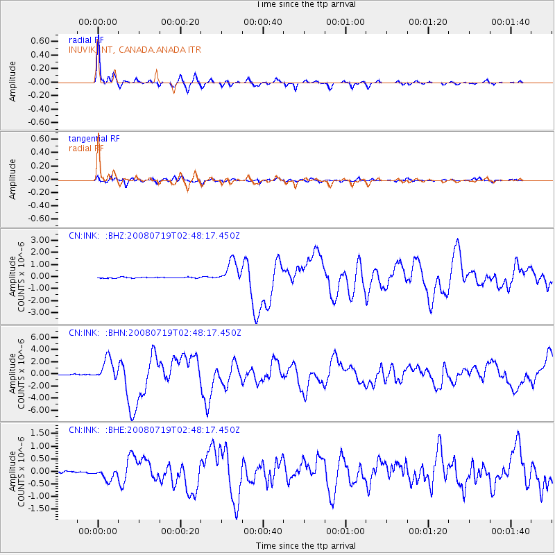
Earthquake location: Off East Coast Of Honshu, Japan
Earthquake latitude/longitude: 37.6/142.2
Earthquake time(UTC): 2008/07/19 (201) 02:39:28 GMT
Earthquake Depth: 22 km
Earthquake Magnitude: 6.2 MB, 7.0 MS, 7.0 MW, 6.9 MW
Earthquake Catalog/Contributor: WHDF/NEIC
Network: CN Canadian National Seismograph Network
Station: INK INUVIK, NT, CANADA.ANADA
Lat/Lon: 68.31 N/133.52 W
Elevation: 40 m
Distance: 53.6 deg
Az: 27.348 deg
Baz: 280.875 deg
Ray Param: 0.06593697
Estimated Moho Depth: 50.25 km
Estimated Crust Vp/Vs: 2.03
Assumed Crust Vp: 6.171 km/s
Estimated Crust Vs: 3.04 km/s
Estimated Crust Poisson's Ratio: 0.34
Radial Match: 97.20651 %
Radial Bump: 302
Transverse Match: 87.62525 %
Transverse Bump: 400
SOD ConfigId: 2504
Insert Time: 2010-02-27 06:12:38.947 +0000
GWidth: 2.5
Max Bumps: 400
Tol: 0.001

Signal To Noise

ChannelStoNSTALTA
CN:INK: :BHN:20080719T02:48:17.450Z27.585221.8777383E-66.807045E-8
CN:INK: :BHE:20080719T02:48:17.450Z5.8049682.3338276E-74.020397E-8
CN:INK: :BHZ:20080719T02:48:17.450Z25.6228459.617771E-73.753592E-8
Arrivals
Ps8.8 SECOND
PpPs24 SECOND
PsPs/PpSs32 SECOND