You are here: Home > Network List > US - United States National Seismic Network Stations List
> Station EGMT Eagleton, Montana, USA > Earthquake Result Viewer
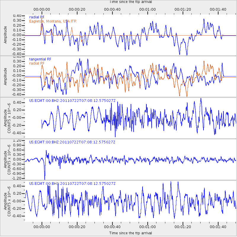
EGMT Eagleton, Montana, USA - Earthquake Result Viewer
*The percent match for this event was below the threshold and hence no stack was calculated.
| Earthquake location: |
Fiji Islands Region |
| Earthquake latitude/longitude: |
-20.3/-178.6 |
| Earthquake time(UTC): |
2011/07/22 (203) 06:56:40 GMT |
| Earthquake Depth: |
612 km |
| Earthquake Magnitude: |
5.9 MB, 6.0 MW, 5.9 MW |
| Earthquake Catalog/Contributor: |
WHDF/NEIC |
|
| Network: |
US United States National Seismic Network |
| Station: |
EGMT Eagleton, Montana, USA |
| Lat/Lon: |
48.02 N/109.75 W |
| Elevation: |
1055 m |
|
| Distance: |
91.6 deg |
| Az: |
38.777 deg |
| Baz: |
241.113 deg |
| Ray Param: |
$rayparam |
*The percent match for this event was below the threshold and hence was not used in the summary stack. |
|
| Radial Match: |
57.578518 % |
| Radial Bump: |
400 |
| Transverse Match: |
45.826267 % |
| Transverse Bump: |
400 |
| SOD ConfigId: |
558545 |
| Insert Time: |
2013-09-18 23:03:13.700 +0000 |
| GWidth: |
2.5 |
| Max Bumps: |
400 |
| Tol: |
0.001 |
|
Signal To Noise
| Channel | StoN | STA | LTA |
| US:EGMT:00:BHZ:20110722T07:08:12.575027Z | 3.7681699 | 3.667594E-7 | 9.7330904E-8 |
| US:EGMT:00:BH1:20110722T07:08:12.575027Z | 1.0788438 | 2.054362E-7 | 1.9042254E-7 |
| US:EGMT:00:BH2:20110722T07:08:12.575027Z | 1.0495048 | 1.6099703E-7 | 1.5340285E-7 |
| Arrivals |
| Ps | |
| PpPs | |
| PsPs/PpSs | |


