You are here: Home > Network List > US - United States National Seismic Network Stations List
> Station NEW Newport, Washington, USA > Earthquake Result Viewer
NEW Newport, Washington, USA - Earthquake Result Viewer
*The percent match for this event was below the threshold and hence no stack was calculated.
| Earthquake location: |
Fiji Islands Region |
| Earthquake latitude/longitude: |
-20.3/-178.6 |
| Earthquake time(UTC): |
2011/07/22 (203) 06:56:40 GMT |
| Earthquake Depth: |
612 km |
| Earthquake Magnitude: |
5.9 MB, 6.0 MW, 5.9 MW |
| Earthquake Catalog/Contributor: |
WHDF/NEIC |
|
| Network: |
US United States National Seismic Network |
| Station: |
NEW Newport, Washington, USA |
| Lat/Lon: |
48.26 N/117.12 W |
| Elevation: |
760 m |
|
| Distance: |
87.6 deg |
| Az: |
35.988 deg |
| Baz: |
235.621 deg |
| Ray Param: |
$rayparam |
*The percent match for this event was below the threshold and hence was not used in the summary stack. |
|
| Radial Match: |
53.026585 % |
| Radial Bump: |
400 |
| Transverse Match: |
72.46819 % |
| Transverse Bump: |
400 |
| SOD ConfigId: |
558545 |
| Insert Time: |
2013-09-18 23:03:37.274 +0000 |
| GWidth: |
2.5 |
| Max Bumps: |
400 |
| Tol: |
0.001 |
|
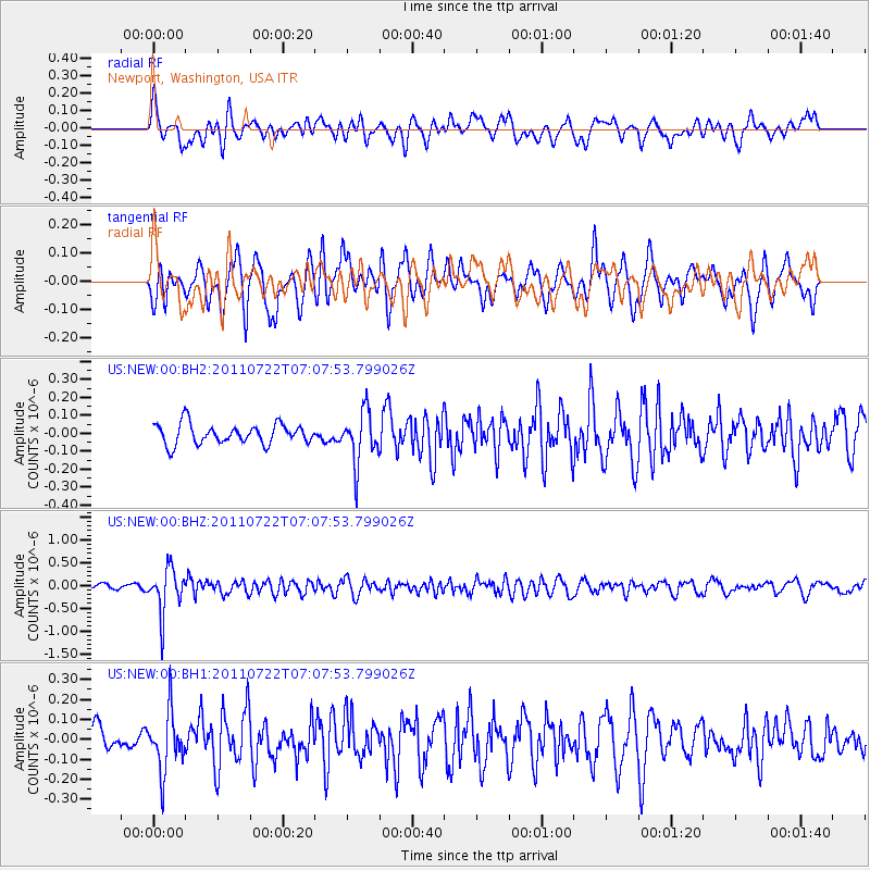
Signal To Noise
| Channel | StoN | STA | LTA |
| US:NEW:00:BHZ:20110722T07:07:53.799026Z | 8.787438 | 4.862963E-7 | 5.533994E-8 |
| US:NEW:00:BH1:20110722T07:07:53.799026Z | 1.4287647 | 1.4531213E-7 | 1.01704735E-7 |
| US:NEW:00:BH2:20110722T07:07:53.799026Z | 2.593022 | 1.4351426E-7 | 5.5346334E-8 |
| Arrivals |
| Ps | |
| PpPs | |
| PsPs/PpSs | |


