NLWA Neilton Lookout, Washington, USA - Earthquake Result Viewer
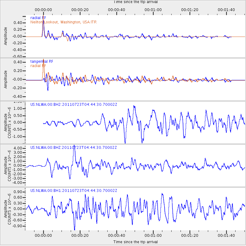
Earthquake location: Near East Coast Of Honshu, Japan
Earthquake latitude/longitude: 38.9/141.8
Earthquake time(UTC): 2011/07/23 (204) 04:34:24 GMT
Earthquake Depth: 41 km
Earthquake Magnitude: 5.9 MB, 5.9 MS, 6.4 MW, 6.3 MW
Earthquake Catalog/Contributor: WHDF/NEIC
Network: US United States National Seismic Network
Station: NLWA Neilton Lookout, Washington, USA
Lat/Lon: 47.39 N/123.87 W
Elevation: 640 m
Distance: 65.2 deg
Az: 48.259 deg
Baz: 301.025 deg
Ray Param: 0.058330715
Estimated Moho Depth: 31.75 km
Estimated Crust Vp/Vs: 1.60
Assumed Crust Vp: 6.566 km/s
Estimated Crust Vs: 4.104 km/s
Estimated Crust Poisson's Ratio: 0.18
Radial Match: 91.61594 %
Radial Bump: 367
Transverse Match: 88.97481 %
Transverse Bump: 400
SOD ConfigId: 558545
Insert Time: 2013-09-18 23:11:51.351 +0000
GWidth: 2.5
Max Bumps: 400
Tol: 0.001

Signal To Noise

ChannelStoNSTALTA
US:NLWA:00:BHZ:20110723T04:44:30.70002Z8.38266851.0706724E-61.2772452E-7
US:NLWA:00:BH1:20110723T04:44:30.70002Z2.38739422.3050534E-79.655102E-8
US:NLWA:00:BH2:20110723T04:44:30.70002Z2.82739833.362286E-71.1891802E-7
Arrivals
Ps3.0 SECOND
PpPs12 SECOND
PsPs/PpSs15 SECOND