TPNV Topopah Spring, Nevada, USA - Earthquake Result Viewer
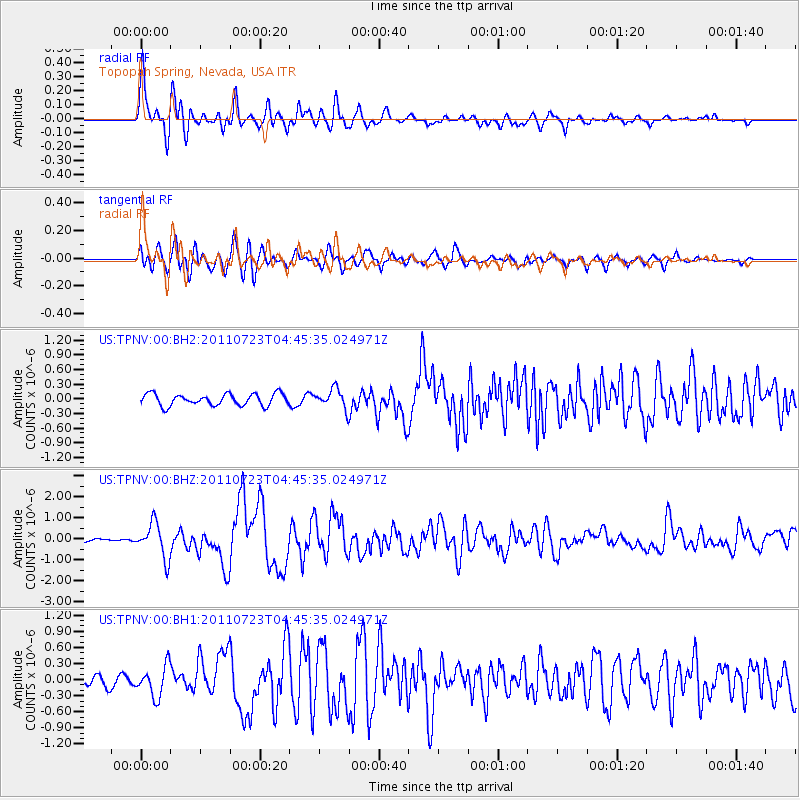
Earthquake location: Near East Coast Of Honshu, Japan
Earthquake latitude/longitude: 38.9/141.8
Earthquake time(UTC): 2011/07/23 (204) 04:34:24 GMT
Earthquake Depth: 41 km
Earthquake Magnitude: 5.9 MB, 5.9 MS, 6.4 MW, 6.3 MW
Earthquake Catalog/Contributor: WHDF/NEIC
Network: US United States National Seismic Network
Station: TPNV Topopah Spring, Nevada, USA
Lat/Lon: 36.95 N/116.25 W
Elevation: 1600 m
Distance: 75.8 deg
Az: 53.943 deg
Baz: 308.052 deg
Ray Param: 0.051344693
Estimated Moho Depth: 11.75 km
Estimated Crust Vp/Vs: 2.10
Assumed Crust Vp: 6.279 km/s
Estimated Crust Vs: 2.993 km/s
Estimated Crust Poisson's Ratio: 0.35
Radial Match: 90.21316 %
Radial Bump: 400
Transverse Match: 87.74767 %
Transverse Bump: 400
SOD ConfigId: 558545
Insert Time: 2013-09-18 23:12:07.521 +0000
GWidth: 2.5
Max Bumps: 400
Tol: 0.001

Signal To Noise

ChannelStoNSTALTA
US:TPNV:00:BHZ:20110723T04:45:35.024971Z14.798488.283768E-75.5977157E-8
US:TPNV:00:BH1:20110723T04:45:35.024971Z2.89343482.841781E-79.821479E-8
US:TPNV:00:BH2:20110723T04:45:35.024971Z1.66451.9785732E-71.1886892E-7
Arrivals
Ps2.1 SECOND
PpPs5.7 SECOND
PsPs/PpSs7.8 SECOND