You are here: Home > Network List > US - United States National Seismic Network Stations List
> Station BRAL Brewton, Alabama, USA > Earthquake Result Viewer
BRAL Brewton, Alabama, USA - Earthquake Result Viewer
*The percent match for this event was below the threshold and hence no stack was calculated.
| Earthquake location: |
Alaska Peninsula |
| Earthquake latitude/longitude: |
54.7/-161.1 |
| Earthquake time(UTC): |
2011/07/23 (204) 06:28:34 GMT |
| Earthquake Depth: |
23 km |
| Earthquake Magnitude: |
5.7 MW, 5.5 MB, 5.7 ML |
| Earthquake Catalog/Contributor: |
NEIC PDE/NEIC PDE-M |
|
| Network: |
US United States National Seismic Network |
| Station: |
BRAL Brewton, Alabama, USA |
| Lat/Lon: |
31.01 N/87.06 W |
| Elevation: |
61 m |
|
| Distance: |
56.4 deg |
| Az: |
82.686 deg |
| Baz: |
317.885 deg |
| Ray Param: |
$rayparam |
*The percent match for this event was below the threshold and hence was not used in the summary stack. |
|
| Radial Match: |
52.16415 % |
| Radial Bump: |
400 |
| Transverse Match: |
54.61589 % |
| Transverse Bump: |
400 |
| SOD ConfigId: |
558545 |
| Insert Time: |
2013-09-18 23:14:34.764 +0000 |
| GWidth: |
2.5 |
| Max Bumps: |
400 |
| Tol: |
0.001 |
|
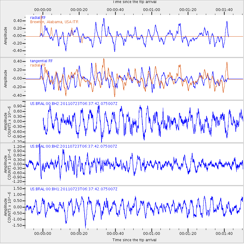
Signal To Noise
| Channel | StoN | STA | LTA |
| US:BRAL:00:BHZ:20110723T06:37:42.075007Z | 2.2283278 | 3.3073925E-7 | 1.4842487E-7 |
| US:BRAL:00:BH1:20110723T06:37:42.075007Z | 1.6500977 | 4.0446332E-7 | 2.4511476E-7 |
| US:BRAL:00:BH2:20110723T06:37:42.075007Z | 1.4412944 | 5.967742E-7 | 4.1405434E-7 |
| Arrivals |
| Ps | |
| PpPs | |
| PsPs/PpSs | |


