You are here: Home > Network List > US - United States National Seismic Network Stations List
> Station MSO Missoula, Montana, USA > Earthquake Result Viewer
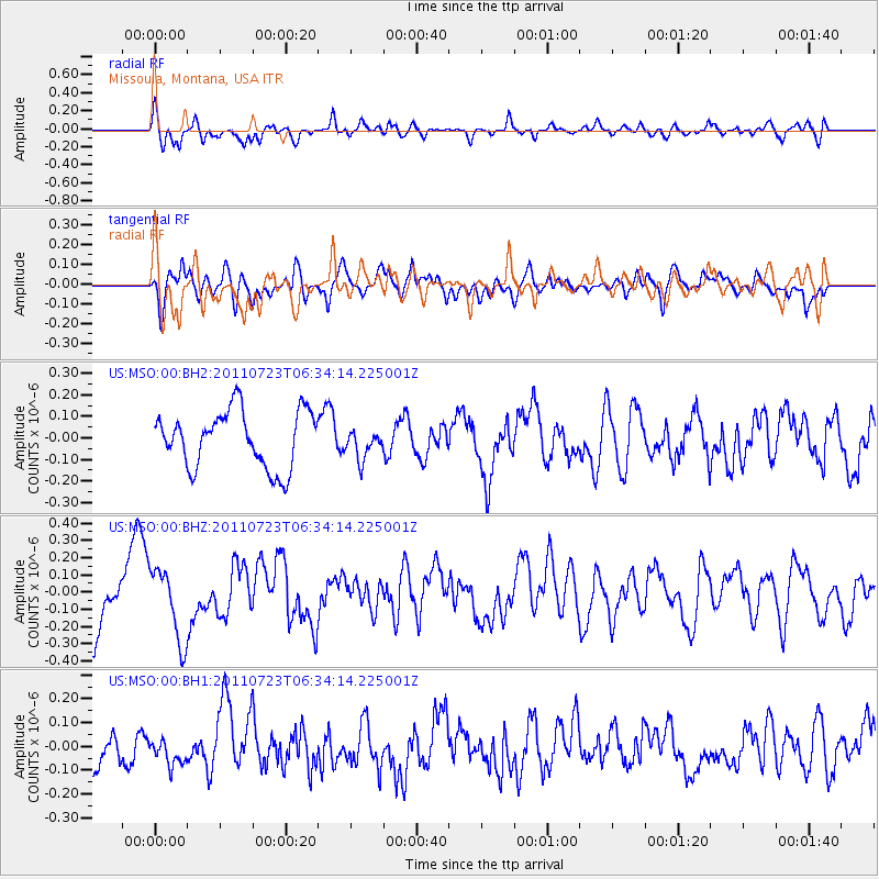
MSO Missoula, Montana, USA - Earthquake Result Viewer
*The percent match for this event was below the threshold and hence no stack was calculated.
| Earthquake location: |
Alaska Peninsula |
| Earthquake latitude/longitude: |
54.7/-161.1 |
| Earthquake time(UTC): |
2011/07/23 (204) 06:28:34 GMT |
| Earthquake Depth: |
23 km |
| Earthquake Magnitude: |
5.7 MW, 5.5 MB, 5.7 ML |
| Earthquake Catalog/Contributor: |
NEIC PDE/NEIC PDE-M |
|
| Network: |
US United States National Seismic Network |
| Station: |
MSO Missoula, Montana, USA |
| Lat/Lon: |
46.83 N/113.94 W |
| Elevation: |
1264 m |
|
| Distance: |
30.4 deg |
| Az: |
85.208 deg |
| Baz: |
302.593 deg |
| Ray Param: |
$rayparam |
*The percent match for this event was below the threshold and hence was not used in the summary stack. |
|
| Radial Match: |
55.104702 % |
| Radial Bump: |
400 |
| Transverse Match: |
47.47558 % |
| Transverse Bump: |
400 |
| SOD ConfigId: |
558545 |
| Insert Time: |
2013-09-18 23:15:22.730 +0000 |
| GWidth: |
2.5 |
| Max Bumps: |
400 |
| Tol: |
0.001 |
|
Signal To Noise
| Channel | StoN | STA | LTA |
| US:MSO:00:BHZ:20110723T06:34:14.225001Z | 1.9607663 | 2.0757632E-7 | 1.058649E-7 |
| US:MSO:00:BH1:20110723T06:34:14.225001Z | 0.7280093 | 5.9252656E-8 | 8.138998E-8 |
| US:MSO:00:BH2:20110723T06:34:14.225001Z | 0.51162803 | 6.728332E-8 | 1.3150827E-7 |
| Arrivals |
| Ps | |
| PpPs | |
| PsPs/PpSs | |


