You are here: Home > Network List > II - Global Seismograph Network (GSN - IRIS/IDA) Stations List
> Station PFO Pinon Flat, California, USA > Earthquake Result Viewer
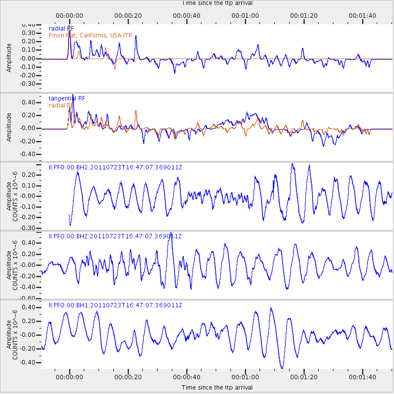
PFO Pinon Flat, California, USA - Earthquake Result Viewer
*The percent match for this event was below the threshold and hence no stack was calculated.
| Earthquake location: |
Mariana Islands |
| Earthquake latitude/longitude: |
13.1/145.3 |
| Earthquake time(UTC): |
2011/07/23 (204) 16:34:41 GMT |
| Earthquake Depth: |
14 km |
| Earthquake Magnitude: |
5.6 MW, 5.5 MW |
| Earthquake Catalog/Contributor: |
NEIC PDE/NEIC PDE-M |
|
| Network: |
II Global Seismograph Network (GSN - IRIS/IDA) |
| Station: |
PFO Pinon Flat, California, USA |
| Lat/Lon: |
33.61 N/116.46 W |
| Elevation: |
1280 m |
|
| Distance: |
89.6 deg |
| Az: |
55.672 deg |
| Baz: |
285.394 deg |
| Ray Param: |
$rayparam |
*The percent match for this event was below the threshold and hence was not used in the summary stack. |
|
| Radial Match: |
52.071636 % |
| Radial Bump: |
400 |
| Transverse Match: |
53.241417 % |
| Transverse Bump: |
400 |
| SOD ConfigId: |
558545 |
| Insert Time: |
2013-09-18 23:16:22.533 +0000 |
| GWidth: |
2.5 |
| Max Bumps: |
400 |
| Tol: |
0.001 |
|
Signal To Noise
| Channel | StoN | STA | LTA |
| II:PFO:00:BHZ:20110723T16:47:07.369011Z | 1.068536 | 1.4124787E-7 | 1.3218822E-7 |
| II:PFO:00:BH1:20110723T16:47:07.369011Z | 2.157158 | 3.208094E-7 | 1.4871853E-7 |
| II:PFO:00:BH2:20110723T16:47:07.369011Z | 1.1043286 | 1.1387325E-7 | 1.0311537E-7 |
| Arrivals |
| Ps | |
| PpPs | |
| PsPs/PpSs | |


