BOZ Bozeman, Montana, USA - Earthquake Result Viewer
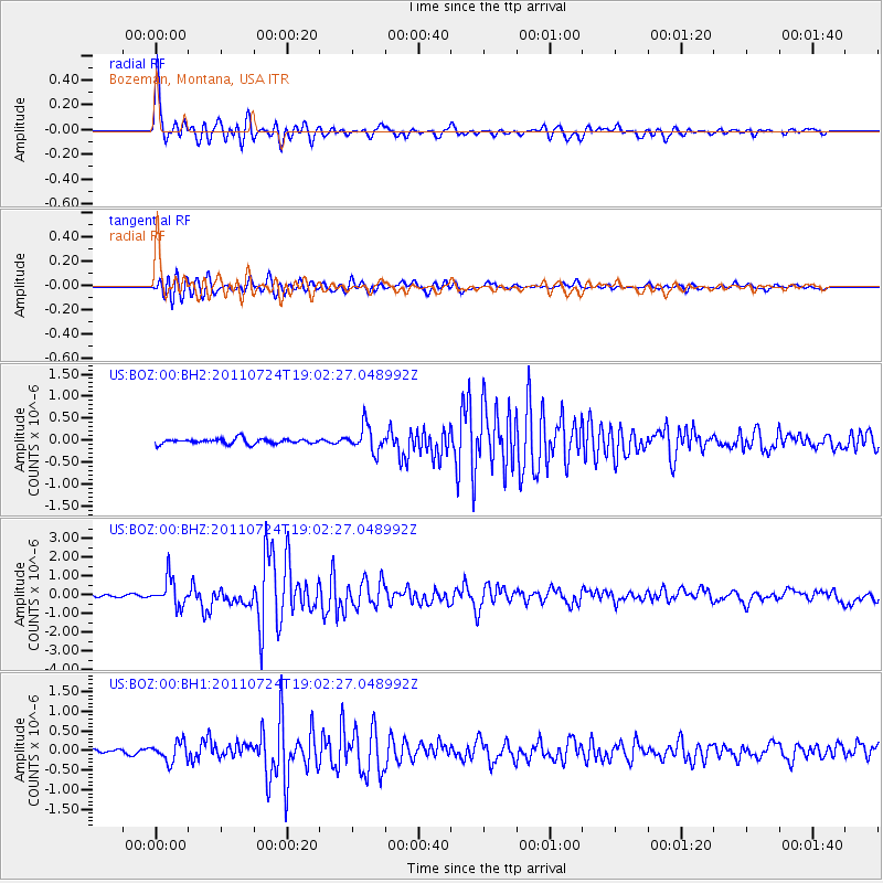
Earthquake location: Near East Coast Of Honshu, Japan
Earthquake latitude/longitude: 37.7/141.4
Earthquake time(UTC): 2011/07/24 (205) 18:51:24 GMT
Earthquake Depth: 35 km
Earthquake Magnitude: 6.3 MB, 5.9 MS, 6.3 MW, 6.3 MW
Earthquake Catalog/Contributor: WHDF/NEIC
Network: US United States National Seismic Network
Station: BOZ Bozeman, Montana, USA
Lat/Lon: 45.65 N/111.63 W
Elevation: 1589 m
Distance: 74.2 deg
Az: 44.2 deg
Baz: 307.996 deg
Ray Param: 0.05242425
Estimated Moho Depth: 29.5 km
Estimated Crust Vp/Vs: 2.09
Assumed Crust Vp: 6.35 km/s
Estimated Crust Vs: 3.042 km/s
Estimated Crust Poisson's Ratio: 0.35
Radial Match: 96.29773 %
Radial Bump: 400
Transverse Match: 88.28922 %
Transverse Bump: 400
SOD ConfigId: 558545
Insert Time: 2013-09-18 23:19:40.269 +0000
GWidth: 2.5
Max Bumps: 400
Tol: 0.001

Signal To Noise

ChannelStoNSTALTA
US:BOZ:00:BHZ:20110724T19:02:27.048992Z12.4060567.257165E-75.849695E-8
US:BOZ:00:BH1:20110724T19:02:27.048992Z3.6488282.4870576E-76.816045E-8
US:BOZ:00:BH2:20110724T19:02:27.048992Z5.0650852.9359342E-75.7964165E-8
Arrivals
Ps5.2 SECOND
PpPs14 SECOND
PsPs/PpSs19 SECOND