You are here: Home > Network List > US - United States National Seismic Network Stations List
> Station ERPA Erie, Pennsylvania, USA > Earthquake Result Viewer
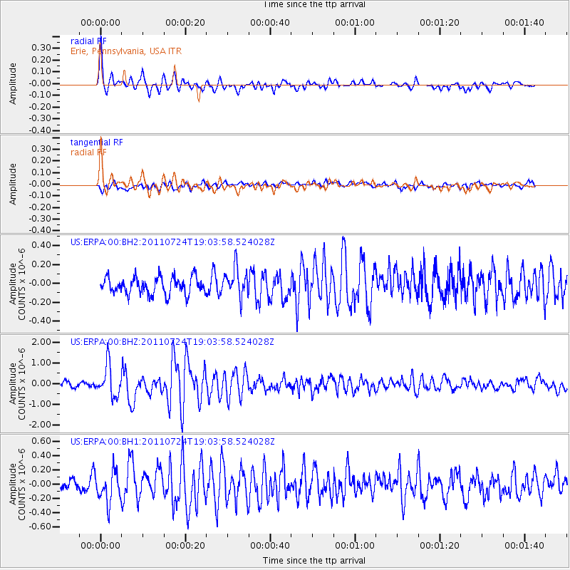
ERPA Erie, Pennsylvania, USA - Earthquake Result Viewer
*The percent match for this event was below the threshold and hence no stack was calculated.
| Earthquake location: |
Near East Coast Of Honshu, Japan |
| Earthquake latitude/longitude: |
37.7/141.4 |
| Earthquake time(UTC): |
2011/07/24 (205) 18:51:24 GMT |
| Earthquake Depth: |
35 km |
| Earthquake Magnitude: |
6.3 MB, 5.9 MS, 6.3 MW, 6.3 MW |
| Earthquake Catalog/Contributor: |
WHDF/NEIC |
|
| Network: |
US United States National Seismic Network |
| Station: |
ERPA Erie, Pennsylvania, USA |
| Lat/Lon: |
42.12 N/79.99 W |
| Elevation: |
306 m |
|
| Distance: |
92.0 deg |
| Az: |
29.483 deg |
| Baz: |
328.364 deg |
| Ray Param: |
$rayparam |
*The percent match for this event was below the threshold and hence was not used in the summary stack. |
|
| Radial Match: |
77.24001 % |
| Radial Bump: |
384 |
| Transverse Match: |
65.072205 % |
| Transverse Bump: |
400 |
| SOD ConfigId: |
558545 |
| Insert Time: |
2013-09-18 23:20:04.095 +0000 |
| GWidth: |
2.5 |
| Max Bumps: |
400 |
| Tol: |
0.001 |
|
Signal To Noise
| Channel | StoN | STA | LTA |
| US:ERPA:00:BHZ:20110724T19:03:58.524028Z | 5.641216 | 7.792538E-7 | 1.381358E-7 |
| US:ERPA:00:BH1:20110724T19:03:58.524028Z | 1.7995163 | 2.1839695E-7 | 1.2136424E-7 |
| US:ERPA:00:BH2:20110724T19:03:58.524028Z | 1.767146 | 1.5764644E-7 | 8.920963E-8 |
| Arrivals |
| Ps | |
| PpPs | |
| PsPs/PpSs | |


