HDIL Hopedale, Illinois, USA - Earthquake Result Viewer
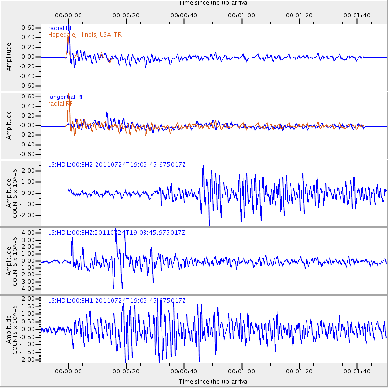
Earthquake location: Near East Coast Of Honshu, Japan
Earthquake latitude/longitude: 37.7/141.4
Earthquake time(UTC): 2011/07/24 (205) 18:51:24 GMT
Earthquake Depth: 35 km
Earthquake Magnitude: 6.3 MB, 5.9 MS, 6.3 MW, 6.3 MW
Earthquake Catalog/Contributor: WHDF/NEIC
Network: US United States National Seismic Network
Station: HDIL Hopedale, Illinois, USA
Lat/Lon: 40.56 N/89.29 W
Elevation: 219 m
Distance: 89.3 deg
Az: 36.125 deg
Baz: 322.155 deg
Ray Param: 0.0418925
Estimated Moho Depth: 35.25 km
Estimated Crust Vp/Vs: 2.02
Assumed Crust Vp: 6.498 km/s
Estimated Crust Vs: 3.217 km/s
Estimated Crust Poisson's Ratio: 0.34
Radial Match: 91.08703 %
Radial Bump: 400
Transverse Match: 85.30921 %
Transverse Bump: 400
SOD ConfigId: 558545
Insert Time: 2013-09-18 23:20:19.876 +0000
GWidth: 2.5
Max Bumps: 400
Tol: 0.001

Signal To Noise

ChannelStoNSTALTA
US:HDIL:00:BHZ:20110724T19:03:45.975017Z12.003949.935657E-78.2769965E-8
US:HDIL:00:BH1:20110724T19:03:45.975017Z3.60341794.6627483E-71.2939793E-7
US:HDIL:00:BH2:20110724T19:03:45.975017Z2.18107723.62426E-71.6616835E-7
Arrivals
Ps5.6 SECOND
PpPs16 SECOND
PsPs/PpSs22 SECOND