INK INUVIK, N.W.T. - Earthquake Result Viewer
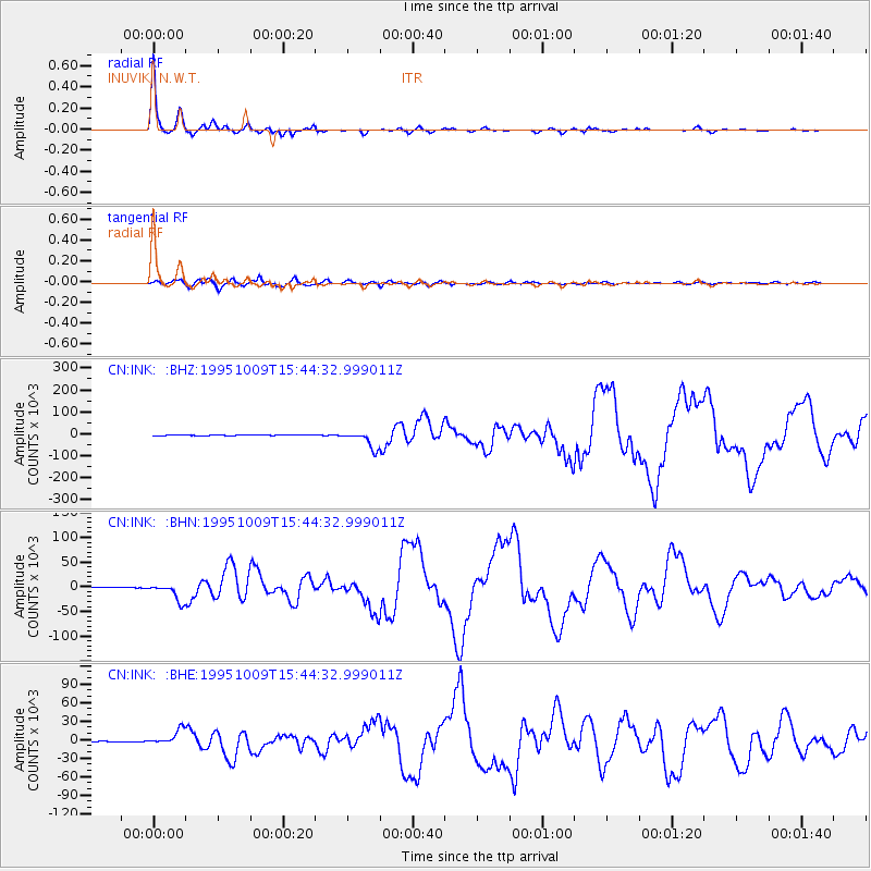
Earthquake location: Near Coast Of Jalisco, Mexico
Earthquake latitude/longitude: 19.1/-104.2
Earthquake time(UTC): 1995/10/09 (282) 15:35:55 GMT
Earthquake Depth: 49 km
Earthquake Magnitude: 6.5 MB, 7.3 MS, 7.3 UNKNOWN, 7.9 MW
Earthquake Catalog/Contributor: WHDF/NEIC
Network: CN Canadian National Seismograph Network
Station: INK INUVIK, N.W.T.
Lat/Lon: 68.31 N/133.52 W
Elevation: 40 m
Distance: 52.5 deg
Az: 346.737 deg
Baz: 144.312 deg
Ray Param: 0.06662058
Estimated Moho Depth: 35.0 km
Estimated Crust Vp/Vs: 1.69
Assumed Crust Vp: 6.171 km/s
Estimated Crust Vs: 3.652 km/s
Estimated Crust Poisson's Ratio: 0.23
Radial Match: 99.12218 %
Radial Bump: 224
Transverse Match: 93.27651 %
Transverse Bump: 400
SOD ConfigId: 6273
Insert Time: 2010-02-27 06:13:40.426 +0000
GWidth: 2.5
Max Bumps: 400
Tol: 0.001

Signal To Noise

ChannelStoNSTALTA
CN:INK: :BHN:19951009T15:44:32.999011Z29.1471317513.184600.8545
CN:INK: :BHE:19951009T15:44:32.999011Z15.26600312224.786800.7851
CN:INK: :BHZ:19951009T15:44:32.999011Z42.5212939159.47920.9379
Arrivals
Ps4.1 SECOND
PpPs14 SECOND
PsPs/PpSs19 SECOND