INK INUVIK, N.W.T. - Earthquake Result Viewer
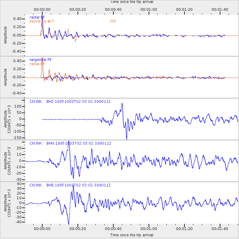
Earthquake location: Peru-Ecuador Border Region
Earthquake latitude/longitude: -2.8/-77.9
Earthquake time(UTC): 1995/10/03 (276) 01:51:24 GMT
Earthquake Depth: 27 km
Earthquake Magnitude: 6.5 MB, 7.0 MS, 6.9 UNKNOWN, 7.0 MW
Earthquake Catalog/Contributor: WHDF/NEIC
Network: CN Canadian National Seismograph Network
Station: INK INUVIK, N.W.T.
Lat/Lon: 68.31 N/133.52 W
Elevation: 40 m
Distance: 80.5 deg
Az: 341.871 deg
Baz: 123.283 deg
Ray Param: 0.048199143
Estimated Moho Depth: 29.5 km
Estimated Crust Vp/Vs: 1.85
Assumed Crust Vp: 6.171 km/s
Estimated Crust Vs: 3.34 km/s
Estimated Crust Poisson's Ratio: 0.29
Radial Match: 97.27633 %
Radial Bump: 357
Transverse Match: 90.40173 %
Transverse Bump: 400
SOD ConfigId: 6273
Insert Time: 2010-02-27 06:13:46.610 +0000
GWidth: 2.5
Max Bumps: 400
Tol: 0.001

Signal To Noise

ChannelStoNSTALTA
CN:INK: :BHN:19951003T02:03:02.399011Z2.79026321266.0935453.75418
CN:INK: :BHE:19951003T02:03:02.399011Z1.57666211913.4411213.6025
CN:INK: :BHZ:19951003T02:03:02.399011Z8.0742826909.1406855.6972
Arrivals
Ps4.2 SECOND
PpPs13 SECOND
PsPs/PpSs17 SECOND