You are here: Home > Network List > II - Global Seismograph Network (GSN - IRIS/IDA) Stations List
> Station WRAB Tennant Creek, NT, Australia > Earthquake Result Viewer
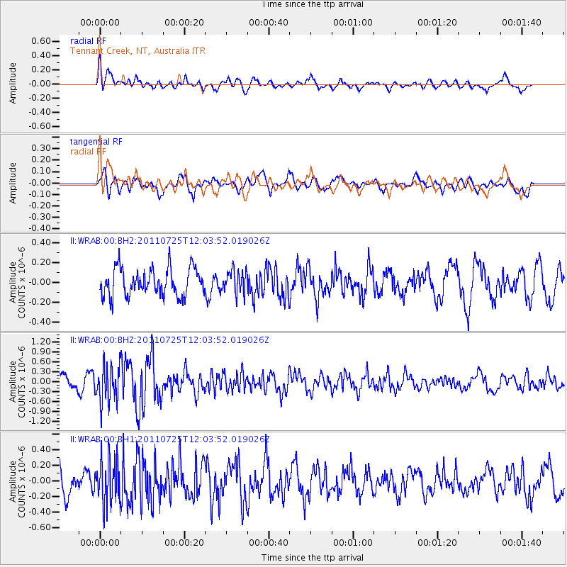
WRAB Tennant Creek, NT, Australia - Earthquake Result Viewer
*The percent match for this event was below the threshold and hence no stack was calculated.
| Earthquake location: |
Near East Coast Of Honshu, Japan |
| Earthquake latitude/longitude: |
35.3/140.9 |
| Earthquake time(UTC): |
2011/07/25 (206) 11:54:54 GMT |
| Earthquake Depth: |
46 km |
| Earthquake Magnitude: |
5.6 MW |
| Earthquake Catalog/Contributor: |
NEIC PDE/NEIC PDE-M |
|
| Network: |
II Global Seismograph Network (GSN - IRIS/IDA) |
| Station: |
WRAB Tennant Creek, NT, Australia |
| Lat/Lon: |
19.93 S/134.36 E |
| Elevation: |
366 m |
|
| Distance: |
55.3 deg |
| Az: |
187.531 deg |
| Baz: |
6.545 deg |
| Ray Param: |
$rayparam |
*The percent match for this event was below the threshold and hence was not used in the summary stack. |
|
| Radial Match: |
68.778625 % |
| Radial Bump: |
400 |
| Transverse Match: |
62.476234 % |
| Transverse Bump: |
400 |
| SOD ConfigId: |
558545 |
| Insert Time: |
2013-09-18 23:26:22.221 +0000 |
| GWidth: |
2.5 |
| Max Bumps: |
400 |
| Tol: |
0.001 |
|
Signal To Noise
| Channel | StoN | STA | LTA |
| II:WRAB:00:BHZ:20110725T12:03:52.019026Z | 2.286119 | 5.5841195E-7 | 2.4426197E-7 |
| II:WRAB:00:BH1:20110725T12:03:52.019026Z | 1.6142294 | 2.9475186E-7 | 1.8259601E-7 |
| II:WRAB:00:BH2:20110725T12:03:52.019026Z | 0.8365446 | 1.149626E-7 | 1.3742556E-7 |
| Arrivals |
| Ps | |
| PpPs | |
| PsPs/PpSs | |


