You are here: Home > Network List > US - United States National Seismic Network Stations List
> Station AMTX Amarillo, Texas, USA > Earthquake Result Viewer
AMTX Amarillo, Texas, USA - Earthquake Result Viewer
*The percent match for this event was below the threshold and hence no stack was calculated.
| Earthquake location: |
Off East Coast Of Kamchatka |
| Earthquake latitude/longitude: |
53.0/159.8 |
| Earthquake time(UTC): |
2011/07/26 (207) 06:17:37 GMT |
| Earthquake Depth: |
33 km |
| Earthquake Magnitude: |
5.6 MW, 5.1 MS, 5.4 MB, 5.4 MW |
| Earthquake Catalog/Contributor: |
WHDF/NEIC |
|
| Network: |
US United States National Seismic Network |
| Station: |
AMTX Amarillo, Texas, USA |
| Lat/Lon: |
34.53 N/101.41 W |
| Elevation: |
1010 m |
|
| Distance: |
68.1 deg |
| Az: |
61.57 deg |
| Baz: |
319.915 deg |
| Ray Param: |
$rayparam |
*The percent match for this event was below the threshold and hence was not used in the summary stack. |
|
| Radial Match: |
46.989117 % |
| Radial Bump: |
400 |
| Transverse Match: |
46.335037 % |
| Transverse Bump: |
400 |
| SOD ConfigId: |
558545 |
| Insert Time: |
2013-09-18 23:31:36.227 +0000 |
| GWidth: |
2.5 |
| Max Bumps: |
400 |
| Tol: |
0.001 |
|
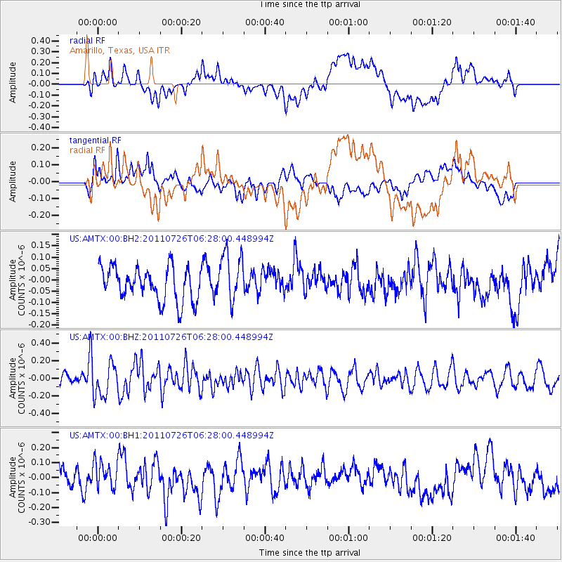
Signal To Noise
| Channel | StoN | STA | LTA |
| US:AMTX:00:BHZ:20110726T06:28:00.448994Z | 2.596936 | 1.8522304E-7 | 7.132368E-8 |
| US:AMTX:00:BH1:20110726T06:28:00.448994Z | 1.3586483 | 9.6350696E-8 | 7.0916585E-8 |
| US:AMTX:00:BH2:20110726T06:28:00.448994Z | 1.0250782 | 7.715989E-8 | 7.52722E-8 |
| Arrivals |
| Ps | |
| PpPs | |
| PsPs/PpSs | |


