You are here: Home > Network List > US - United States National Seismic Network Stations List
> Station EGMT Eagleton, Montana, USA > Earthquake Result Viewer
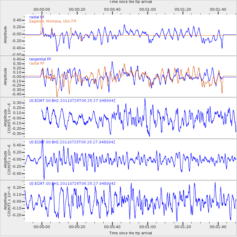
EGMT Eagleton, Montana, USA - Earthquake Result Viewer
*The percent match for this event was below the threshold and hence no stack was calculated.
| Earthquake location: |
Off East Coast Of Kamchatka |
| Earthquake latitude/longitude: |
53.0/159.8 |
| Earthquake time(UTC): |
2011/07/26 (207) 06:17:37 GMT |
| Earthquake Depth: |
33 km |
| Earthquake Magnitude: |
5.6 MW, 5.1 MS, 5.4 MB, 5.4 MW |
| Earthquake Catalog/Contributor: |
WHDF/NEIC |
|
| Network: |
US United States National Seismic Network |
| Station: |
EGMT Eagleton, Montana, USA |
| Lat/Lon: |
48.02 N/109.75 W |
| Elevation: |
1055 m |
|
| Distance: |
54.0 deg |
| Az: |
56.029 deg |
| Baz: |
311.683 deg |
| Ray Param: |
$rayparam |
*The percent match for this event was below the threshold and hence was not used in the summary stack. |
|
| Radial Match: |
50.1366 % |
| Radial Bump: |
400 |
| Transverse Match: |
53.157436 % |
| Transverse Bump: |
400 |
| SOD ConfigId: |
558545 |
| Insert Time: |
2013-09-18 23:32:14.554 +0000 |
| GWidth: |
2.5 |
| Max Bumps: |
400 |
| Tol: |
0.001 |
|
Signal To Noise
| Channel | StoN | STA | LTA |
| US:EGMT:00:BHZ:20110726T06:26:27.948994Z | 3.6133153 | 2.4899586E-7 | 6.891064E-8 |
| US:EGMT:00:BH1:20110726T06:26:27.948994Z | 1.0423274 | 9.532321E-8 | 9.145227E-8 |
| US:EGMT:00:BH2:20110726T06:26:27.948994Z | 1.0083392 | 1.01499005E-7 | 1.0065959E-7 |
| Arrivals |
| Ps | |
| PpPs | |
| PsPs/PpSs | |


