You are here: Home > Network List > US - United States National Seismic Network Stations List
> Station MSO Missoula, Montana, USA > Earthquake Result Viewer
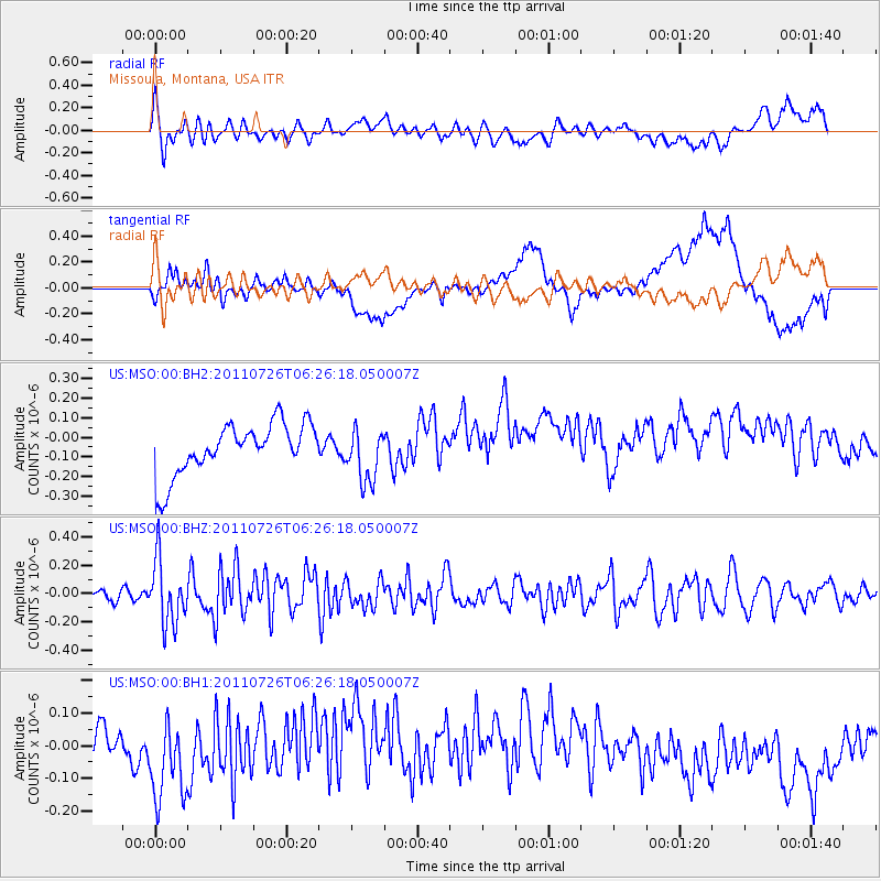
MSO Missoula, Montana, USA - Earthquake Result Viewer
*The percent match for this event was below the threshold and hence no stack was calculated.
| Earthquake location: |
Off East Coast Of Kamchatka |
| Earthquake latitude/longitude: |
53.0/159.8 |
| Earthquake time(UTC): |
2011/07/26 (207) 06:17:37 GMT |
| Earthquake Depth: |
33 km |
| Earthquake Magnitude: |
5.6 MW, 5.1 MS, 5.4 MB, 5.4 MW |
| Earthquake Catalog/Contributor: |
WHDF/NEIC |
|
| Network: |
US United States National Seismic Network |
| Station: |
MSO Missoula, Montana, USA |
| Lat/Lon: |
46.83 N/113.94 W |
| Elevation: |
1264 m |
|
| Distance: |
52.7 deg |
| Az: |
59.482 deg |
| Baz: |
310.67 deg |
| Ray Param: |
$rayparam |
*The percent match for this event was below the threshold and hence was not used in the summary stack. |
|
| Radial Match: |
52.491444 % |
| Radial Bump: |
400 |
| Transverse Match: |
36.70854 % |
| Transverse Bump: |
400 |
| SOD ConfigId: |
558545 |
| Insert Time: |
2013-09-18 23:32:55.640 +0000 |
| GWidth: |
2.5 |
| Max Bumps: |
400 |
| Tol: |
0.001 |
|
Signal To Noise
| Channel | StoN | STA | LTA |
| US:MSO:00:BHZ:20110726T06:26:18.050007Z | 3.591969 | 2.264645E-7 | 6.304745E-8 |
| US:MSO:00:BH1:20110726T06:26:18.050007Z | 0.9693839 | 1.0546507E-7 | 1.0879598E-7 |
| US:MSO:00:BH2:20110726T06:26:18.050007Z | 1.0325735 | 1.3509882E-7 | 1.3083701E-7 |
| Arrivals |
| Ps | |
| PpPs | |
| PsPs/PpSs | |


