
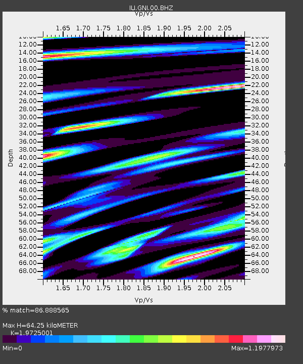
GNI Garni, Armenia - Earthquake Result Viewer
| ||||||||||||||||||
| ||||||||||||||||||
| ||||||||||||||||||
|
Signal To Noise
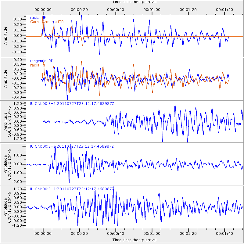
| Channel | StoN | STA | LTA |
| IU:GNI:00:BHZ:20110727T23:12:17.468987Z | 6.335188 | 3.7742194E-7 | 5.9575495E-8 |
| IU:GNI:00:BH1:20110727T23:12:17.468987Z | 1.0893608 | 7.352819E-8 | 6.7496636E-8 |
| IU:GNI:00:BH2:20110727T23:12:17.468987Z | 2.08002 | 1.1323337E-7 | 5.4438598E-8 |
| Arrivals | |
| Ps | 10 SECOND |
| PpPs | 30 SECOND |
| PsPs/PpSs | 40 SECOND |

