You are here: Home > Network List > US - United States National Seismic Network Stations List
> Station DGMT Dagmar, Montana, USA > Earthquake Result Viewer
DGMT Dagmar, Montana, USA - Earthquake Result Viewer
*The percent match for this event was below the threshold and hence no stack was calculated.
| Earthquake location: |
Northern Mid-Atlantic Ridge |
| Earthquake latitude/longitude: |
10.8/-43.4 |
| Earthquake time(UTC): |
2011/07/27 (208) 23:00:30 GMT |
| Earthquake Depth: |
10 km |
| Earthquake Magnitude: |
5.6 MB, 5.6 MS, 6.0 MW, 5.9 MW |
| Earthquake Catalog/Contributor: |
WHDF/NEIC |
|
| Network: |
US United States National Seismic Network |
| Station: |
DGMT Dagmar, Montana, USA |
| Lat/Lon: |
48.47 N/104.20 W |
| Elevation: |
0.0 m |
|
| Distance: |
62.7 deg |
| Az: |
319.194 deg |
| Baz: |
105.25 deg |
| Ray Param: |
$rayparam |
*The percent match for this event was below the threshold and hence was not used in the summary stack. |
|
| Radial Match: |
79.90747 % |
| Radial Bump: |
400 |
| Transverse Match: |
55.646782 % |
| Transverse Bump: |
400 |
| SOD ConfigId: |
558545 |
| Insert Time: |
2013-09-18 23:38:24.885 +0000 |
| GWidth: |
2.5 |
| Max Bumps: |
400 |
| Tol: |
0.001 |
|
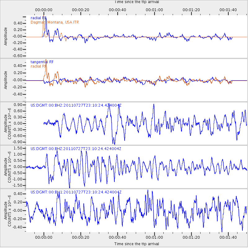
Signal To Noise
| Channel | StoN | STA | LTA |
| US:DGMT:00:BHZ:20110727T23:10:24.424004Z | 5.8129544 | 6.8055664E-7 | 1.17075864E-7 |
| US:DGMT:00:BH1:20110727T23:10:24.424004Z | 1.0413476 | 1.4678596E-7 | 1.409577E-7 |
| US:DGMT:00:BH2:20110727T23:10:24.424004Z | 1.1639646 | 2.8047577E-7 | 2.4096587E-7 |
| Arrivals |
| Ps | |
| PpPs | |
| PsPs/PpSs | |


