You are here: Home > Network List > US - United States National Seismic Network Stations List
> Station HDIL Hopedale, Illinois, USA > Earthquake Result Viewer
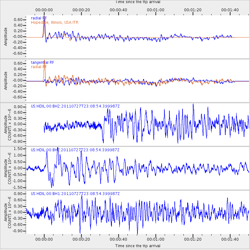
HDIL Hopedale, Illinois, USA - Earthquake Result Viewer
*The percent match for this event was below the threshold and hence no stack was calculated.
| Earthquake location: |
Northern Mid-Atlantic Ridge |
| Earthquake latitude/longitude: |
10.8/-43.4 |
| Earthquake time(UTC): |
2011/07/27 (208) 23:00:30 GMT |
| Earthquake Depth: |
10 km |
| Earthquake Magnitude: |
5.6 MB, 5.6 MS, 6.0 MW, 5.9 MW |
| Earthquake Catalog/Contributor: |
WHDF/NEIC |
|
| Network: |
US United States National Seismic Network |
| Station: |
HDIL Hopedale, Illinois, USA |
| Lat/Lon: |
40.56 N/89.29 W |
| Elevation: |
219 m |
|
| Distance: |
50.1 deg |
| Az: |
314.496 deg |
| Baz: |
113.101 deg |
| Ray Param: |
$rayparam |
*The percent match for this event was below the threshold and hence was not used in the summary stack. |
|
| Radial Match: |
78.99845 % |
| Radial Bump: |
400 |
| Transverse Match: |
70.72869 % |
| Transverse Bump: |
400 |
| SOD ConfigId: |
558545 |
| Insert Time: |
2013-09-18 23:38:52.696 +0000 |
| GWidth: |
2.5 |
| Max Bumps: |
400 |
| Tol: |
0.001 |
|
Signal To Noise
| Channel | StoN | STA | LTA |
| US:HDIL:00:BHZ:20110727T23:08:54.399987Z | 10.771679 | 7.3419176E-7 | 6.815945E-8 |
| US:HDIL:00:BH1:20110727T23:08:54.399987Z | 1.426974 | 2.3605263E-7 | 1.6542181E-7 |
| US:HDIL:00:BH2:20110727T23:08:54.399987Z | 3.2086592 | 4.0350346E-7 | 1.2575454E-7 |
| Arrivals |
| Ps | |
| PpPs | |
| PsPs/PpSs | |


